La Sagrera–Sant Andreu (Barcelona) Masterplan
Core idea
HSR station area with urban park and housing
Why it matters
Major node of Barcelona’s rail and urban network
Description
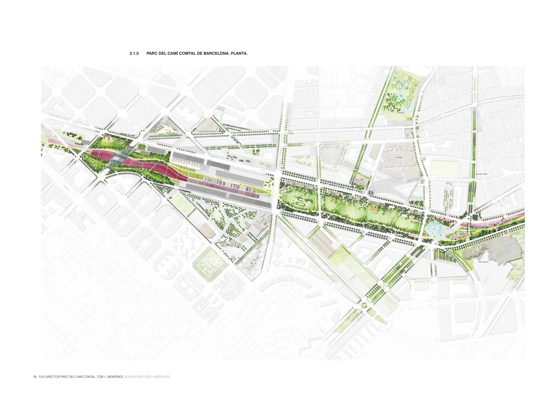
The La Sagrera-Sant Andreu masterplan, coordinated from around 2010 by the Barcelona Sagrera Alta Velocitat consortium of state, Catalan and municipal governments, restructures a broad rail corridor in north-east Barcelona around a new high-speed rail interchange at La Sagrera. The plan covers the corridor with a linear park of several kilometres, the Parc del Camí Comtal, and arranges housing, offices and facilities along its edges, knitting together districts long severed by the tracks.
Significance
La Sagrera continues Barcelona's tradition of using major infrastructure to drive urban restructuring, following the 1992 Olympic waterfront and the 22@ district. Covering the rail trench to create a linear park makes it a prominent European example of infrastructure-capping urbanism and station-area development. Prolonged delays and financing difficulties have also made it a case study in the risks of mega-project coordination among multiple levels of government.
What shaped it
- Transit-oriented development (TOD) (1993)
- The linear park / greenway (1878 / 2009 revival)
- Plan of Chicago (1909)
Sources
- https://en.wikipedia.org/wiki/Sagrera_railway_station
- https://ajuntament.barcelona.cat/ecologiaurbana/en/bodies-involved/citizen-participation/sagrera