Luanda Master Plan
Core idea
New satellite towns & ring roads
Why it matters
Post-war rebuilding at scale
Description
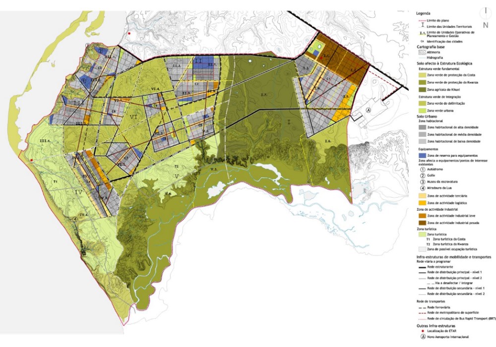
The Luanda Master Plan of 2007, promoted by the Provincial Government of Luanda, set a framework for the reconstruction and expansion of the Angolan capital after the end of the civil war in 2002. Its principal moves were a system of ring roads to relieve the congested colonial core and the promotion of new satellite towns and centralities on the periphery, most famously realised in Chinese-built projects such as Kilamba. The plan responded to explosive population growth and the vast informal musseque settlements surrounding the city.
Significance
The plan is significant as an instance of oil-financed, state-led reconstruction urbanism in post-conflict Africa, drawing on decentralisation and new-town ideas at a metropolitan scale. Its satellite cities have become emblematic in debates about Chinese involvement in African urbanisation, housing affordability and the gap between planned centralities and the informal city where most residents live.
What shaped it
- The master plan (early 20th c.)
- World becomes majority urban (2007)
Plans it influenced
- Nova Cidade de Kilamba (Luanda) (2011–)
Sources
- https://www.pasgr.org/wp-content/uploads/2016/11/Urban-Governance-and-Turning-African-Cities-Aro
- https://www.a1v2.pt/en/portfolio/global-city/