Manila (Intramuros)
Core idea
Spanish gridiron-and-bastion walled city laid out around a central plaza at the mouth of the Pasig
Why it matters
Pre-dated and then templated Laws-of-the-Indies colonial urbanism across the Spanish Far East
Description
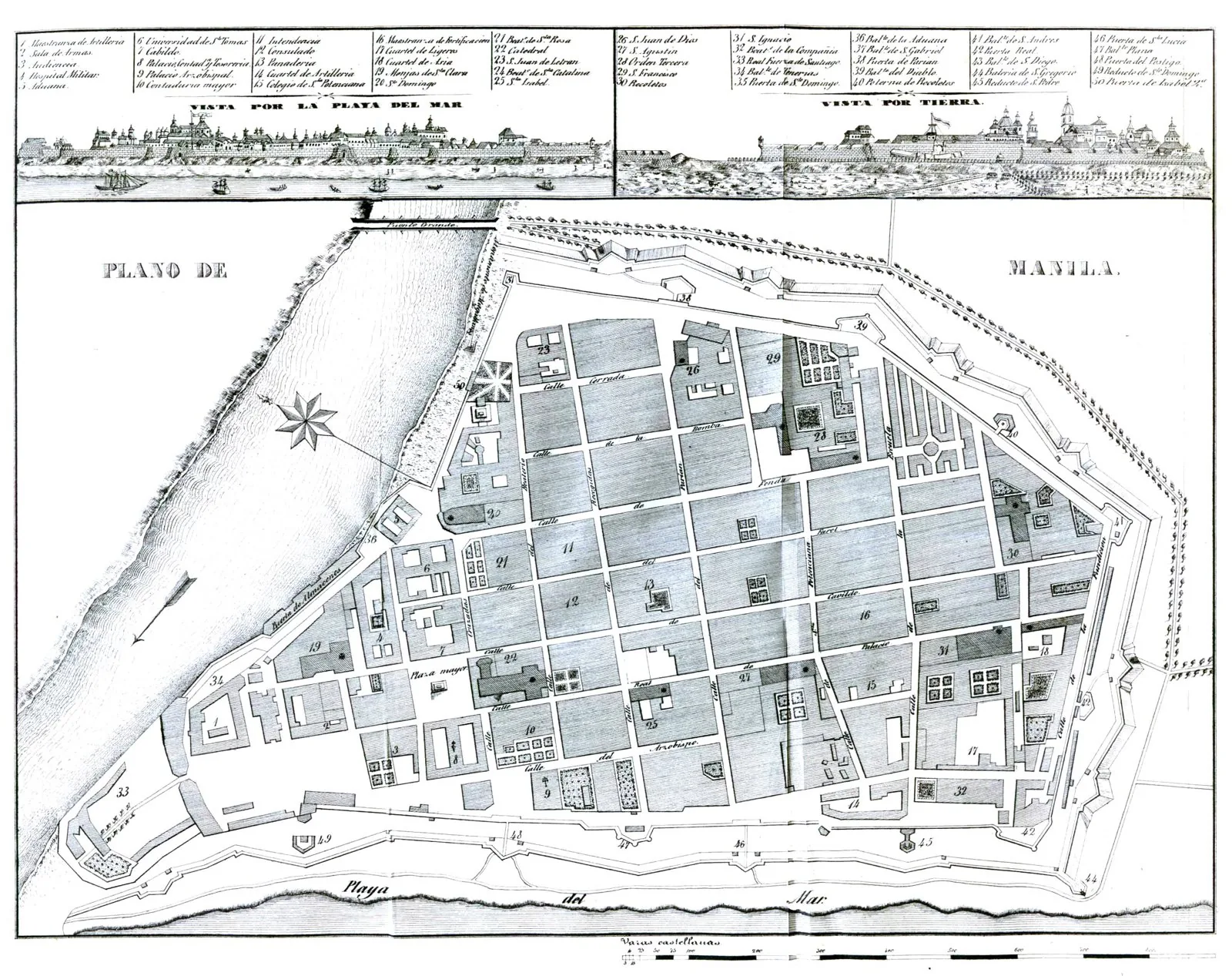
Intramuros, the walled core of Manila, was laid out in 1571 under Miguel López de Legazpi, first governor-general of the Philippines, on a peninsula where the Pasig river meets Manila Bay. Its gridiron of streets, central plaza and reserved civic and religious blocks were established before the 1573 Ordinances codified such planning, making Intramuros an early prototype rather than a copy. Initially defended by a timber palisade, the settlement was rebuilt in quarried adobe, with Fort Santiago, curtain walls and a sequence of bastions, ravelins and redoubts eventually enclosing some sixty-four hectares. For over three centuries it served as the capital of Spain's empire in the Far East.
Significance
Intramuros is among the largest surviving fully fortified European colonial cities in Southeast Asia and a key node of the Manila galleon trade linking Asia and the Americas. Its grid-and-plaza scheme prefigured the Laws of the Indies and became a reference for Spanish town-founding across the Pacific, embedding a European bastioned model deep within the Asian maritime world.
What became of it
Partially realised and built up as the fortified Spanish administrative core of Manila around Plaza Mayor; survived as the seat of colonial government until largely flattened in the 1945 Battle of Manila, then partly reconstructed and restored.
Critique
Critics note Intramuros embodied colonial exclusion, walling Spanish residents off from the Filipino and Chinese populations relegated to the extramuros suburbs, a segregationist urban order.
What shaped it
- Laws of the Indies (1573)
- Ocean-going caravel, galleon and navigation (15th–16th c.)
- Spanish conquest of the Americas (1519–1572)
- The Treaty of Tordesillas (1494)