Miletus
Core idea
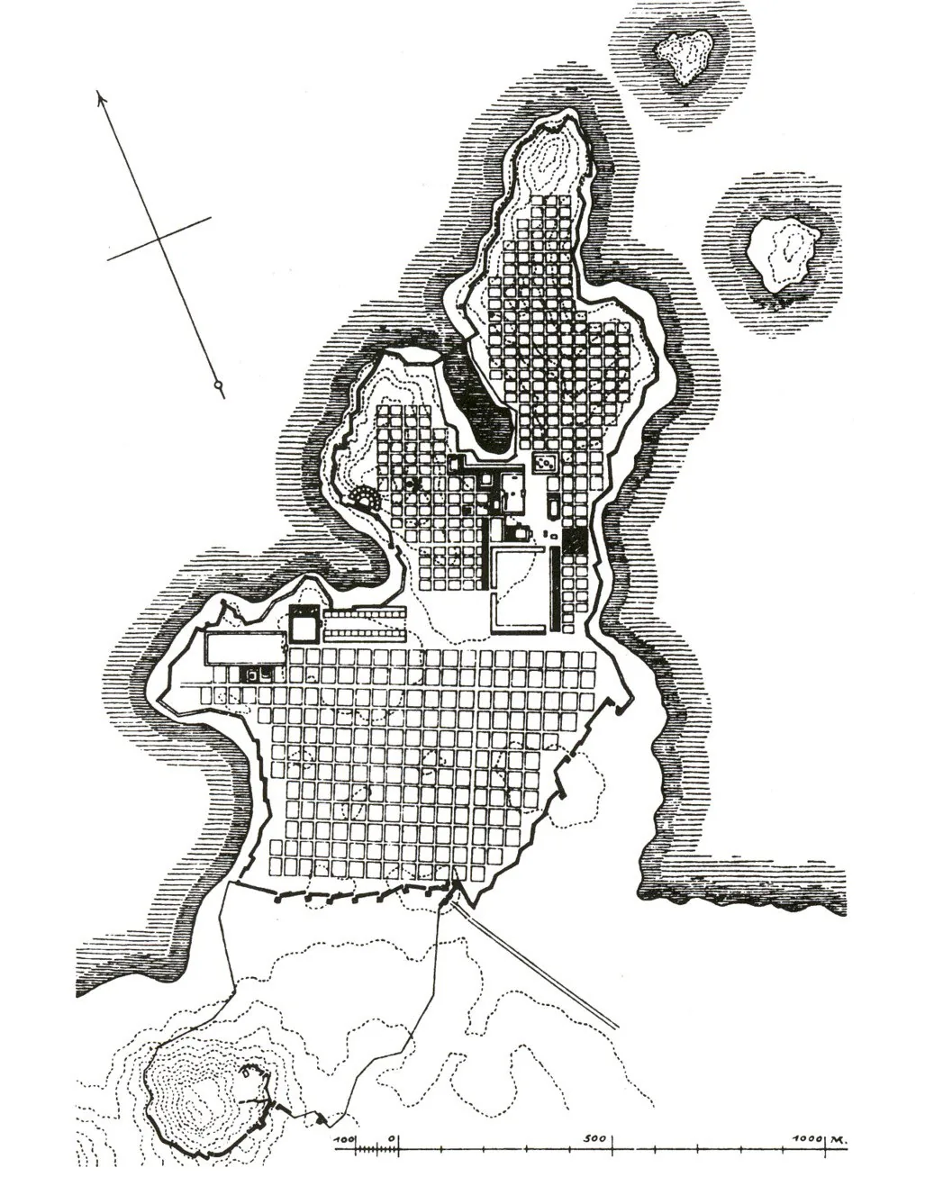
Canonical orthogonal grid with agora/harbor alignment
Why it matters
Prototype for rational town layout in the classical world
Description
Laid out on the coast of Asia Minor after the Persians razed the old town in 494 BCE, Miletus was rebuilt on a strict orthogonal grid credited to Hippodamus, often called the first town planner. Uniform rectangular blocks were divided into public, sacred, and residential zones, with the agora and harbours integrated into the geometric order. The plan treated the city as a rational, repeatable system rather than an organic accretion.
Significance
Miletus gave the Western tradition its founding myth of the planner and the idea that a city can be designed as an abstract grid of equal parts. The 'Hippodamian plan' became the template for Greek colonies and, through Rome, for gridded cities across the world.
What became of it
Replanned on an orthogonal grid after 479 BCE and built out through the Hellenistic period; the harbour silted up as the Maeander delta advanced, leaving the once-coastal city stranded inland and gradually abandoned.
Critique
Scholars dispute whether Hippodamus personally designed Miletus, noting orthogonal planning predates him and the literary attribution is later and thin.
What shaped it
- The grid (c. 2500 BCE)
- The plaza / forum / agora (c. 500 BCE)
- Athenian democracy (508/507 BCE)
Plans it influenced
Sources
- https://en.wikipedia.org/wiki/Hippodamus_of_Miletus
- https://www.livius.org/articles/concept/hippodamian-plan/