Nansha New Area (Guangzhou)
Core idea
FTZ + port-led urbanization
Why it matters
Southern PRD logistics/innovation
Description
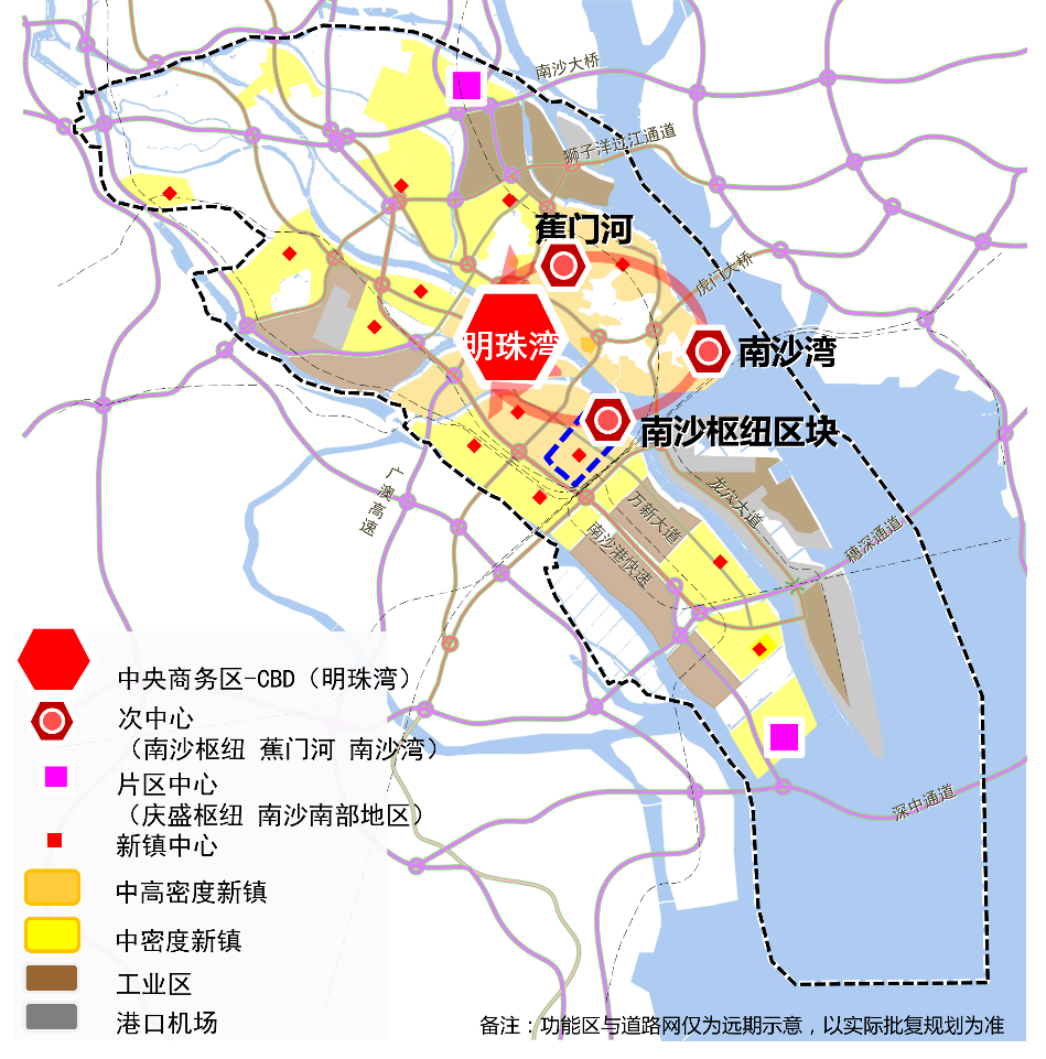
A state-level new area designated in 2012 at Nansha, the southern port district of Guangzhou, at the mouth of the Pearl River. The plan combines a deep-water port and logistics complex with a free trade zone, established in 2015, and large-scale urbanisation intended to create a new coastal centre for the city oriented towards the Greater Bay Area. Development is led by the Guangzhou municipality and state enterprises, mixing industrial, innovation and residential districts across an extensive delta site.
Significance
Nansha exemplifies China's state-capitalist megaproject urbanism, in which special-zone status, port infrastructure and city-building are fused into a single growth strategy. Its trajectory is closely watched in debates on the Greater Bay Area's polycentric structure and on the risks of building large new districts ahead of demand.
What shaped it
- Shenzhen Special Economic Zone (1980)
- Containerised-logistics scale-up (1970s–1990s)
- China's reform & opening (1978)
- Transit-oriented development (TOD) (1993)
Sources
- https://en.wikipedia.org/wiki/Nansha,_Guangzhou
- https://investinchina.chinadaily.com.cn/s/201805/15/WS5c7de92e498e27e338039970/nansha-new-area.h