Nota Ruimte
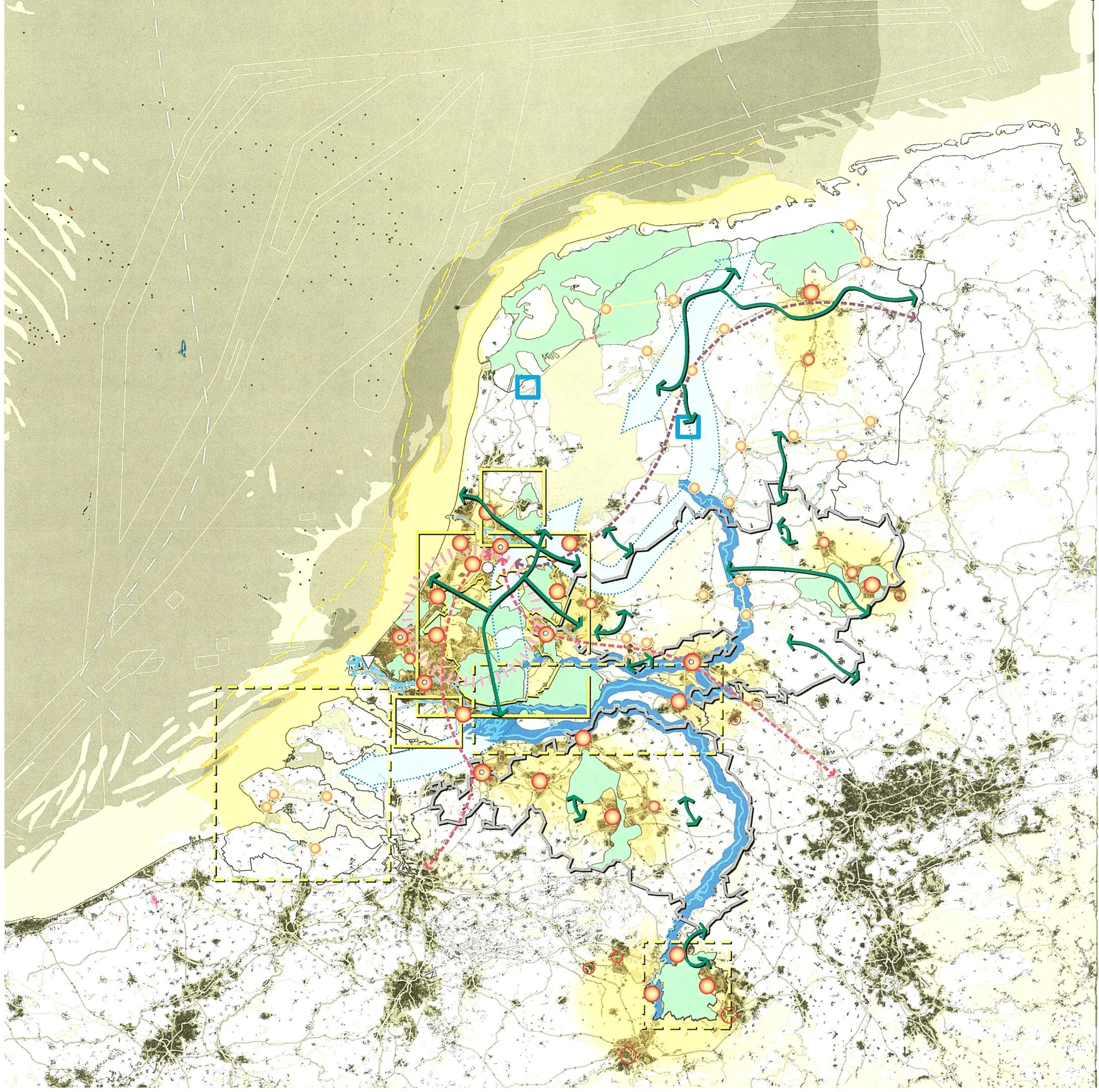
Core idea
Spatial strategy: compact + mainports
Why it matters
Set national priorities pre-SVIR
Description
The Nota Ruimte (Spatial Memorandum) of 2004 was the Dutch national government's spatial strategy, replacing the tradition of detailed national land-use directives with a framework of national priorities. It concentrated state involvement on a compact set of aims, including strengthening the Randstad, supporting the 'mainports' of Schiphol airport and the Port of Rotterdam, bundling urbanisation with infrastructure, and devolving many spatial decisions to provinces and municipalities under the motto of decentralising what could be decentralised.
Significance
The Nota Ruimte marks a turning point in Dutch planning, loosening the strong central steering associated with earlier national reports and the VINEX programme in favour of decentralisation and development-oriented planning. It set the terms for the subsequent SVIR and the further retreat of national spatial policy, and it features prominently in debates about whether the celebrated Dutch planning tradition was dismantled or modernised in the 2000s.
What shaped it
- The compact city (1973-1990s)
- Neoliberalism (1970s–1990s)
- Sustainable development (Brundtland) (1987)
Plans it influenced
- Nationale Omgevingsvisie (NOVI – National Strategy on Spatial Planning and the Environment) (2020)
- Ontwerp-Nota Ruimte (2024)
Sources
- https://link.springer.com/article/10.1007/s10901-005-9024-3
- https://www.mlit.go.jp/kokudokeikaku/international/spw/general/netherlands/index_e.html