Paris Plan Vélo & RER Vélo
Core idea
Protected bike lanes + regional cycle superhighways
Why it matters
Global cycling urbanism benchmark
Description
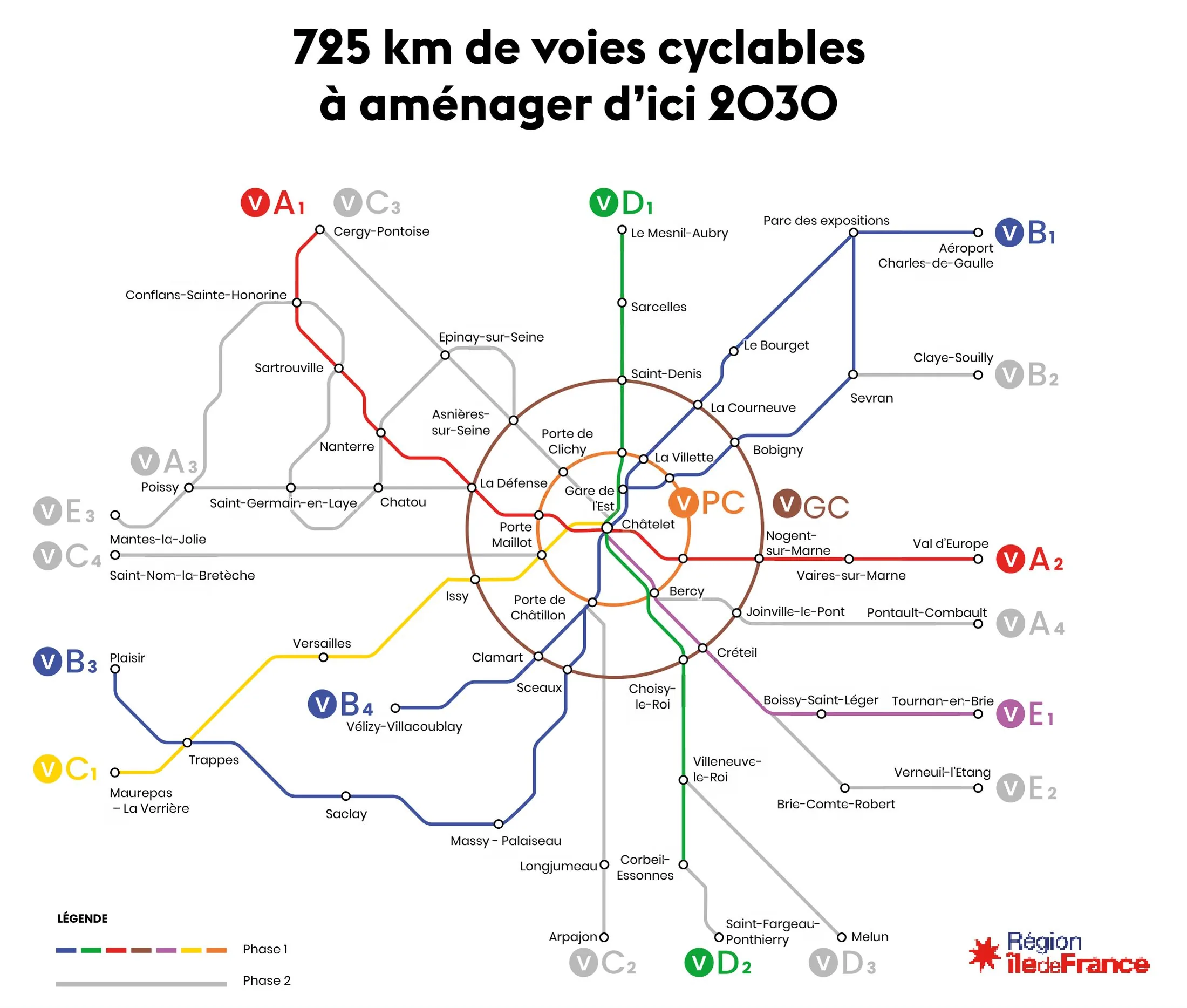
A rolling programme of cycling infrastructure led by the Ville de Paris under Mayor Anne Hidalgo from 2015, extended by the Île-de-France region's RER Vélo network of regional cycle superhighways. Successive Plan Vélo phases delivered protected bike lanes on major boulevards, the transformation of riverside expressways, mass cycle parking and 'coronapiste' conversions during the pandemic, aiming to make Paris a fully cyclable city and to link it to its suburbs by high-capacity cycle routes.
Significance
The Paris cycling programme became the most watched demonstration that a dense, car-oriented capital could be rapidly retrofitted for cycling, shifting international benchmarks previously set by Dutch and Danish cities. It is central to debates on tactical implementation, the '15-minute city' agenda and the politics of reallocating road space, and has directly inspired emulation across Europe and beyond.
What shaped it
- The bicycle (safety bicycle 1885)
- Tactical urbanism (2010s)
- Paris Climate Agreement (2015)