Pondicherry (Puducherry) Dual City
Core idea
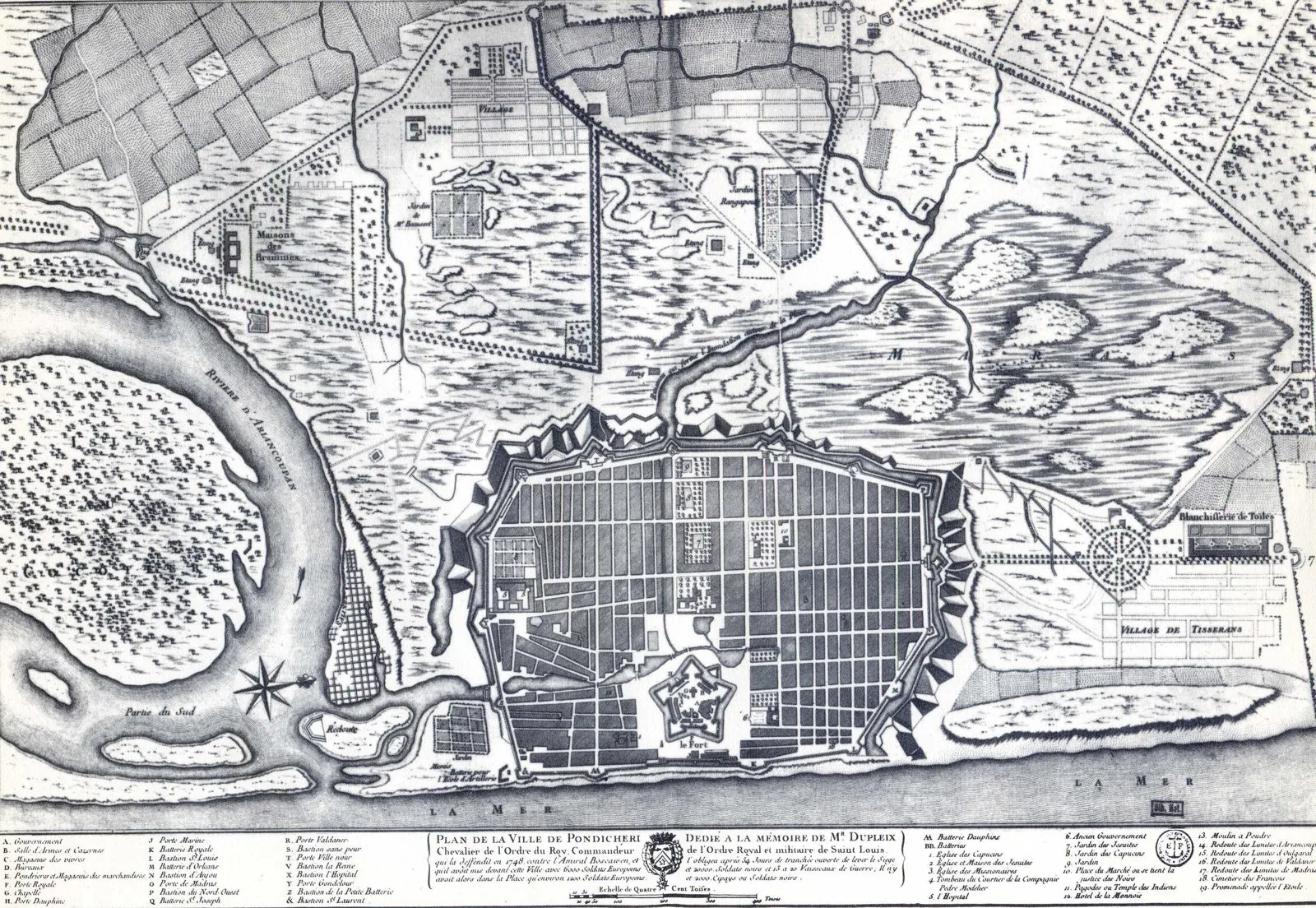
Canal divides French colonial grid (Ville Blanche — orthogonal, boulevard-lined) from the Tamil organic quarter (Ville Noire) — two planning traditions coexisting in one city
Why it matters
Most legible example of colonial vs. indigenous urbanism side by side; raises powerful questions about whose planning logic dominates and how cities absorb cultural duality
Description
Developed under French rule from 1674, Pondicherry was split by a canal into two cities: the 'Ville Blanche,' a rigorously orthogonal grid of broad streets and colonnaded villas, and the 'Ville Noire,' the denser, organically grown Tamil town. Two planning cultures sat side by side, separated by a line of water.
Significance
Pondicherry is the most legible example anywhere of colonial and indigenous urbanism juxtaposed within one city. It poses, in built form, the central question of colonial planning — whose spatial logic governs, and who is kept on which side of the line.
What became of it
Realised and largely preserved; Pondicherry remained French until 1954, after which it became the Indian union territory of Puducherry, with the gridded White Town and its French architecture still intact.
Critique
The plan formalised colonial racial and caste segregation, physically dividing European and Indian populations across the canal.
What shaped it
- The Dutch Republic and the VOC (1581 / 1602)
- The grid (c. 2500 BCE)
- The British Empire and modern colonialism (1600 – 20th c.)
- Ocean-going caravel, galleon and navigation (15th–16th c.)
Plans it influenced
Sources
- https://www.iias.asia/the-review/pondicherry-under-french-illuminating-urban-landscape-1674-1793
- https://en.wikipedia.org/wiki/Pondicherry