Porto Matosinhos-Leixões Waterfront Plan
Core idea
Port–city interface upgrades
Why it matters
Reconnecting industrial waterfronts
Description
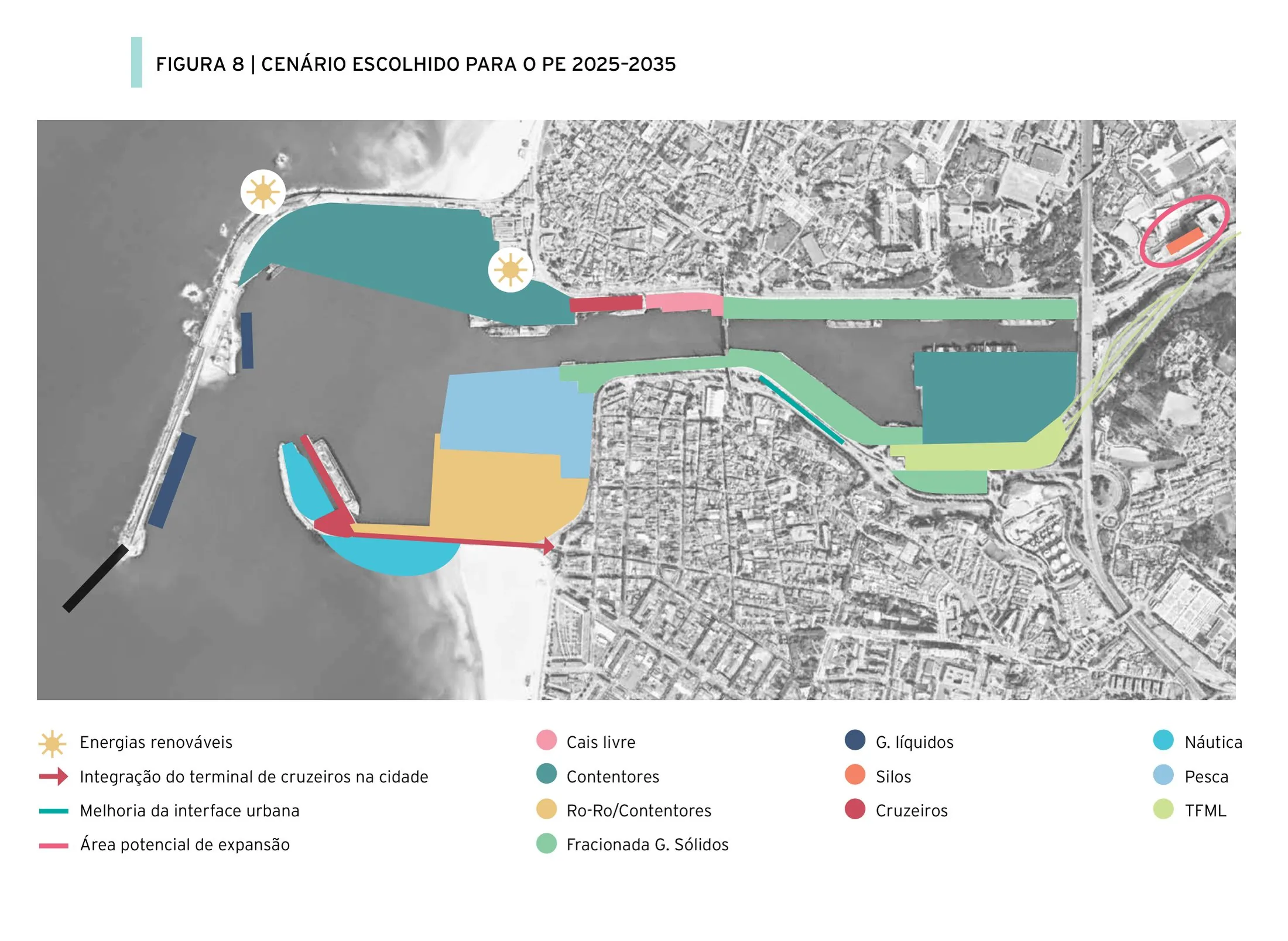
A waterfront plan of the 2010s for the seafront and harbour edge shared by Matosinhos and the Port of Leixões in the Porto metropolitan area, prepared by the port authority APDL with the affected municipalities. The plan coordinates upgrades at the port–city interface: a new cruise terminal, improved public access to quaysides and beaches, landscape treatment of the industrial edge, and better connections between the working port and the surrounding urban fabric.
Significance
The plan is a Portuguese instance of the wider European effort to reconnect cities with active industrial waterfronts rather than relocating port functions wholesale. The Leixões cruise terminal became an architectural emblem of this approach, and the plan is cited in port–city literature for managing coexistence — rather than replacement — of logistics and urban life.
What shaped it
- Containerised-logistics scale-up (1970s–1990s)
- The master plan (early 20th c.)
- Landscape urbanism (Waldheim) (1997-2006)
Sources
- https://www.forumdascidades.pt/sites/default/files/Projetos/ctur_lap_matosinhos_apdl.pdf
- https://en.wikipedia.org/wiki/Porto_Leix%C3%B5es_Cruise_Terminal