Sofia General Development Plan 2030
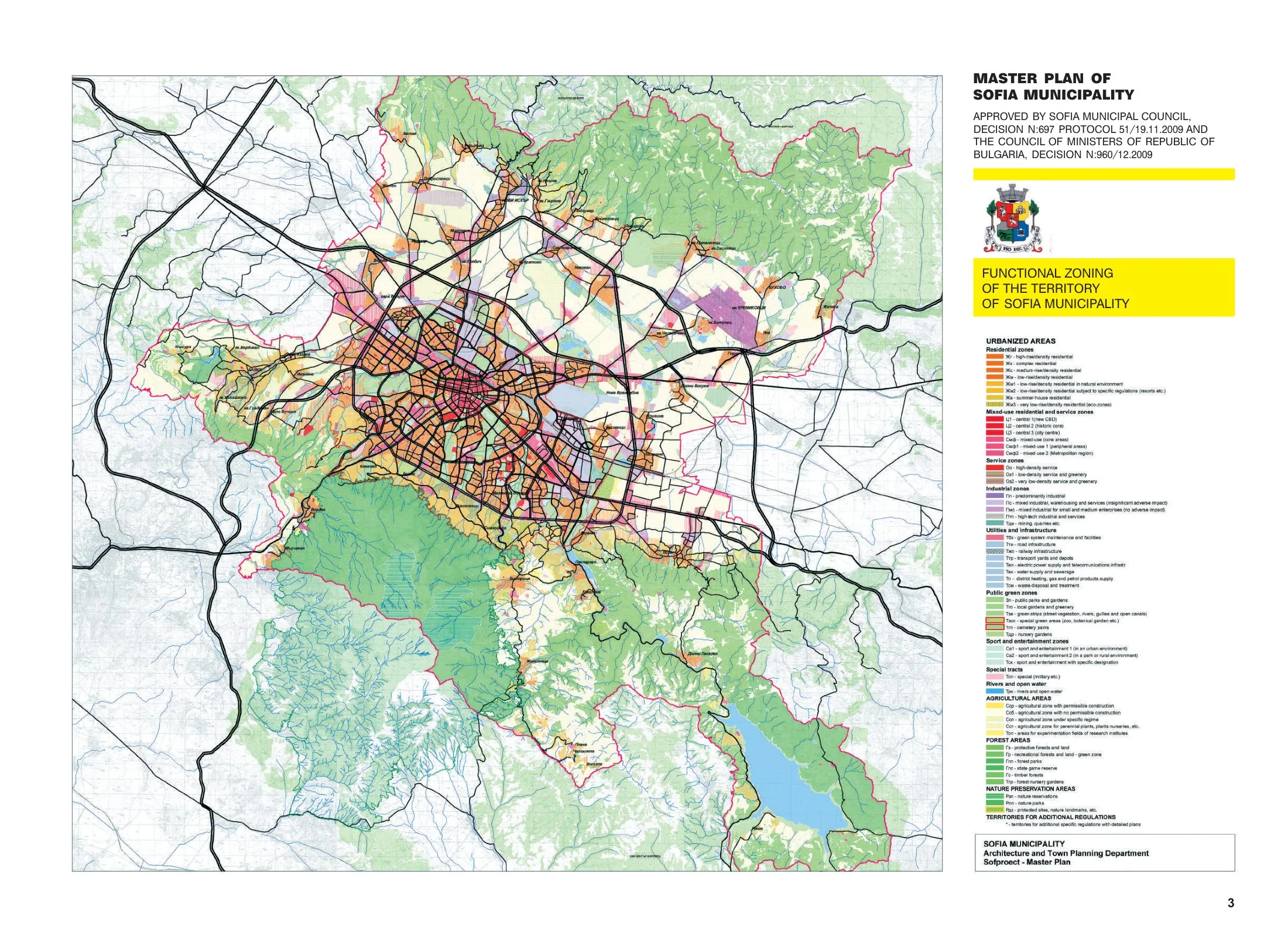
Core idea
Ring metro, green wedges
Why it matters
Balances expansion with mountain landscapes
Description
The Sofia General Development Plan, prepared by the municipal planning institute Sofproekt and carried forward through the 2010s towards a 2030 horizon, is the Bulgarian capital's statutory master plan. It structures growth around an expanding metro network, including orbital and radial lines, while protecting a system of green wedges that connect the city to the Vitosha mountain to the south. The plan seeks to channel post-socialist market development into corridors served by public transport rather than dispersed peripheral sprawl.
Significance
The plan is significant as an attempt to reassert comprehensive planning in a post-socialist capital where restitution and rapid private building had weakened public control. Its pairing of metro-led corridor development with landscape protection places it within the wider European turn to transit-oriented planning, and it is frequently discussed in debates on how Southeast European cities manage growth pressure against inherited green-space systems.
What shaped it
- Garden Cities of To-Morrow (1898 / 1902)
- The green belt (1898 concept / 1938 law)
- The compact city (1973-1990s)
- Global financial crisis (2007–2009)
Sources
- https://sofiaplan.bg/wp-content/uploads/2020/09/SofiaMasterPlan2009_report.pdf
- https://www.researchgate.net/publication/311883021_The_Challenges_of_Implementing_Sustainable_De