Tampa Downtown Riverwalk Plan
Core idea
Continuous riverwalk + mixed-use
Why it matters
Waterfront public realm transformation
Description
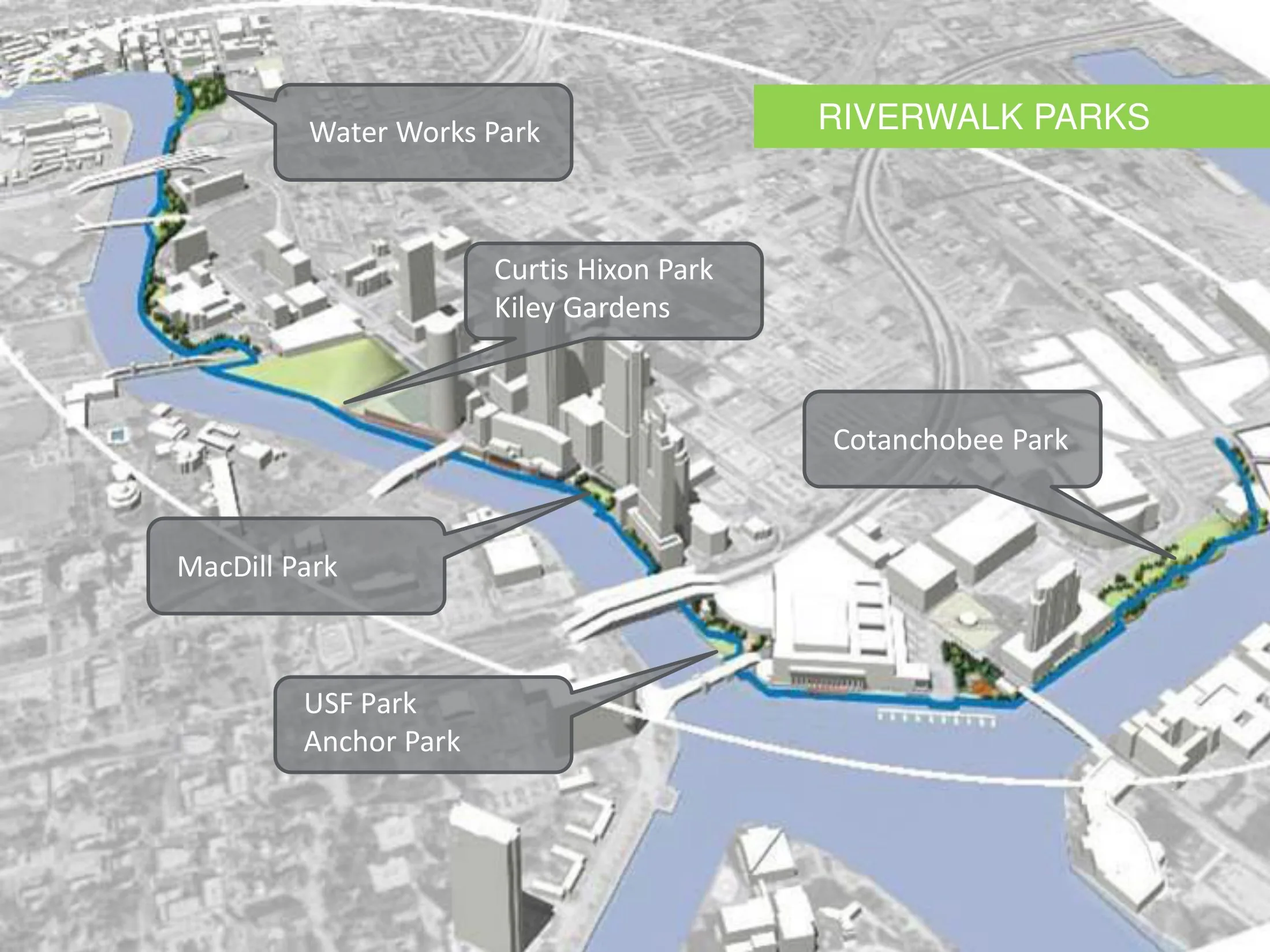
A city-led plan, advanced through the 2010s by the City of Tampa with partner agencies, to complete a continuous public riverwalk along the Hillsborough River through downtown Tampa. The plan links parks, museums and convention facilities with a waterfront promenade and pairs the route with mixed-use redevelopment of adjoining districts, including former industrial and parking lands along the river.
Significance
The Riverwalk is a representative case of the American downtown waterfront playbook, in which a linear public spine is used to reorient a car-dominated central business district towards its river and to catalyse private investment. Its role in Tampa's downtown revival, including the adjacent Water Street district, is often cited in Sun Belt debates on public-realm-led regeneration.
What shaped it
- The linear park / greenway (1878 / 2009 revival)
- Landscape urbanism (Waldheim) (1997-2006)
- Global financial crisis (2007–2009)
- The Death and Life of Great American Cities (1961)
Sources
- https://www.tampa.gov/document/tampa-riverwalk-master-plan-9871
- https://en.wikipedia.org/wiki/Tampa_Riverwalk