Thames Gateway Planning Framework
Core idea
East London–Thames Estuary regeneration corridor
Why it matters
Largest regeneration area in Western Europe at launch
Description
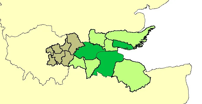
The Thames Gateway Planning Framework (RPG9a), issued by the UK Government in 1995, designated a 60-kilometre corridor of largely brownfield and estuarine land from East London through north Kent and south Essex as a strategic regeneration zone. Building on earlier East Thames Corridor studies, it set a framework for housing growth, transport investment including the Channel Tunnel Rail Link, and economic development across many local authority areas, later carried forward by the Sustainable Communities Plan of 2003 and successive delivery bodies.
Significance
At launch the Thames Gateway was described as the largest regeneration area in Western Europe, and it became the defining British experiment in corridor-scale, brownfield-led growth planning. It shaped debates about eastward rebalancing of London, flood risk on the estuary, and the difficulty of coordinating dozens of agencies without a single development corporation. Its uneven delivery is often cited in discussions of governance capacity in mega-regeneration, even as pieces such as Stratford and Ebbsfleet advanced.
What shaped it
- Containerised-logistics scale-up (1970s–1990s)
- The compact city (1973-1990s)
- Transit-oriented development (TOD) (1993)
Plans it influenced
- Barking Riverside Masterplan (2015)
Sources
- https://en.wikipedia.org/wiki/Thames_Gateway
- https://programmeofficers.co.uk/Highsted/CoreDocuments/CD16%20-%20National%20Policy%20and%20Guid