Tianjin Foreign Concessions
Core idea
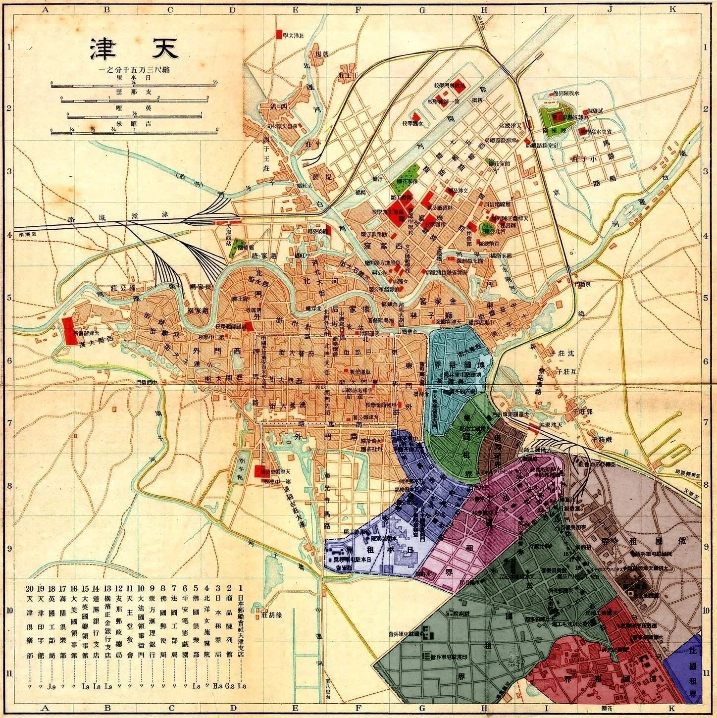
Side-by-side patchwork of self-governed foreign concessions along the Hai River.
Why it matters
Most fragmented, multinational example of colonial urbanism in China.
Description
Opening with the British and French concessions in 1860 and expanding to nine concessions held by eight powers by about 1902, Tianjin's foreign quarters formed a patchwork strung along the Hai (Peiho) River. Each concession was largely self-contained, with its own municipal council, police, schools, barracks and street network, and each imported its home country's urban form and architecture, from the British Bund and Victoria Park to distinct French, German, Italian, Russian and Japanese quarters. The most prosperous zones occupied the river's right bank, producing a continuous belt of contrasting national townscapes within a single Chinese city.
Significance
The Tianjin concessions represent the most extreme case of fragmented colonial city-making in China, a single port carved into numerous quasi-sovereign enclaves, each a built catalogue of its nation's planning ideals. The arrangement made Tianjin a leading treaty port and introduced infrastructure such as China's first modern tramway in 1906. Returned to China by 1947, the surviving quarters remain an open-air museum of competing nineteenth- and early twentieth-century European urban models.
What shaped it
- The British Empire and modern colonialism (1600 – 20th c.)
- Industrial Revolution accelerates (c. 1769)
- The grid (c. 2500 BCE)
Plans it influenced
- Shimla Colonial Hill Station (1864)
Sources
- https://en.wikipedia.org/wiki/Foreign_concessions_in_Tianjin
- https://en.wikipedia.org/wiki/British_concession_in_Tianjin