Tikal
Core idea
Dispersed temple-pyramids, causeways (sacbeob), and reservoir network in tropical forest
Why it matters
Defines the low-density "garden city" model of Maya urbanism; challenges Western assumptions about what a city looks like
Description
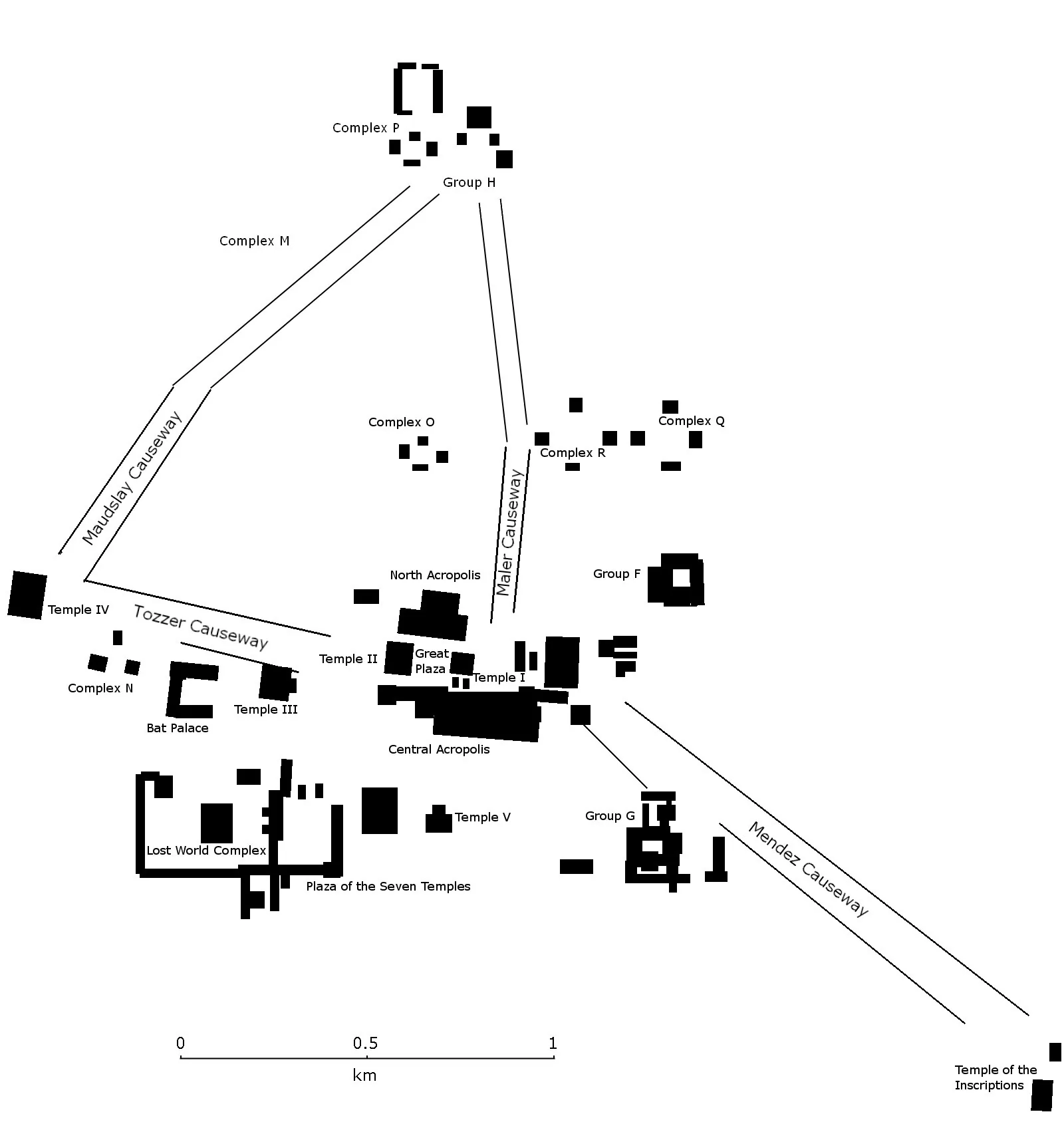
Tikal flourished in the rainforest of present-day Guatemala from before 300 BCE to around 900 CE, organized not as a dense core but as a dispersed network of towering limestone temple-pyramids, plazas, and elite compounds linked by raised causeways (sacbeob). Vast reservoirs carved into the bedrock captured rainwater to sustain the city through the dry season in a region with no rivers.
Significance
Tikal exemplifies the low-density, garden-city pattern of Maya urbanism, challenging the assumption that cities must be compact and walled. Its reliance on engineered water storage — and the role drought likely played in its collapse — makes it a powerful early lesson in environmental limits.
What became of it
Grew over centuries as a dispersed monumental city with causeways and reservoirs, peaking in the Late Classic; experienced the 9th-century 'Maya collapse', was abandoned, and reclaimed by forest until modern excavation and conservation as a national park.
Critique
The widely circulated '7-11 million' figure applies to the entire region, not Tikal, and critics warn LiDAR structure counts are routinely overinterpreted as simultaneous population.
What shaped it
- The Mesoamerican ceremonial centre and ballcourt (c. 500 BCE onward)
- The ziggurat / temple-platform (c. 3000 BCE)
- Agriculture and the Neolithic revolution (from c. 9500 BCE)
Plans it influenced
- Chichén Itzá (c. 600–1200 CE)