Tiwanaku
Core idea
An Andean imperial ceremonial capital with an axially aligned monumental core laid out on a cosmological plan.
Why it matters
A high-altitude state capital whose monumental geometry projected political and religious authority across the Andes.
Description
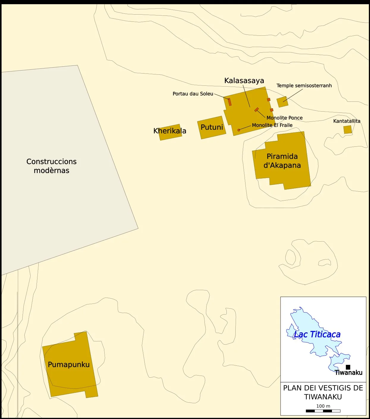
Tiwanaku lies near the southern shore of Lake Titicaca in highland Bolivia, the spiritual and political centre of a pre-Columbian state that flourished from about 300 to 1000 CE, reaching its apogee between roughly 500 and 900. Its monumental core is organised around aligned ceremonial structures: the terraced Akapana pyramid, the rectangular Kalasasaya enclosure with its semi-subterranean temple and the megalithic Pumapunku platform, several oriented to cardinal axes. Built with precisely cut and fitted andesite and sandstone blocks, the complex combined ritual precincts, plazas and elite enclosures. Surrounding raised-field agriculture and water management sustained a dense population across the altiplano around the ceremonial capital.
Significance
Tiwanaku shows how an Andean state materialised cosmological and political order through monumental, axially planned architecture at extreme altitude. Its precise stonework, astronomically referenced enclosures and integrated agricultural hinterland influenced later Andean cultures, including the Inca. As one of South America's largest pre-Columbian sites, it is central to understanding ceremonial capital-building and cosmological urbanism in the highlands.
What became of it
Andean ceremonial-administrative capital that reached its height c. AD 800; the political regime collapsed rapidly c. AD 1010-1050 and the monumental core and city were abandoned within roughly a century, leaving ruins now partly reconstructed and a UNESCO site.
Critique
Kolata's pan-Andean drought model for the collapse has been undercut by recent Bayesian chronologies showing the city-wide collapse occurred decades before the documented reduction in precipitation, shifting explanation toward internal socio-political dynamics.
What shaped it
- The ziggurat / temple-platform (c. 3000 BCE)
- Andean agricultural terracing (andenes) (c. 600 BCE onward; Inca peak 15th c. CE)
- Waru-waru raised-field agriculture (c. 300 BCE–1000 CE)
- The Mesoamerican ceremonial centre and ballcourt (c. 500 BCE onward)
Plans it influenced
- Cusco (Inca Capital) (c. 1400–1533)