Toronto Port Lands Flood Protection / Don Mouth Naturalization
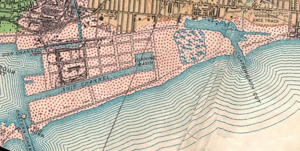
Core idea
River re-naturalization unlocking urbanization
Why it matters
Large-scale climate adaptation enabling city-building
Description
A large flood protection and river engineering project on Toronto's waterfront, led by the tri-government agency Waterfront Toronto with landscape architects Michael Van Valkenburgh Associates, under construction from 2017. The project carved a new naturalised mouth for the Don River through the derelict Port Lands, creating wetlands, parkland and a new island district (Villiers Island) while removing flood risk from a wide swathe of the eastern downtown. It is among North America's largest urban river re-naturalisation works.
Significance
The project is a leading example of climate adaptation deployed as city-building: ecological infrastructure is the precondition that unlocks long-blocked urban development land. It carries forward the landscape urbanism ideas rehearsed in the 2000s Lower Don competitions into built form, and it is widely cited internationally as a model for governance and financing of large-scale resilience works on post-industrial waterfronts.
What shaped it
- Landscape urbanism (Waldheim) (1997-2006)
- Urban resilience (2013)
- Paris Climate Agreement (2015)
- Silent Spring (Carson) (1962)
Sources
- https://www.waterfrontoronto.ca/our-projects/don-mouth-naturalization-and-port-lands-flood-prote
- https://www.mvvainc.com/projects/port-lands-flood-protection