Vauxhall Nine Elms Battersea (VNEB) Opportunity Area
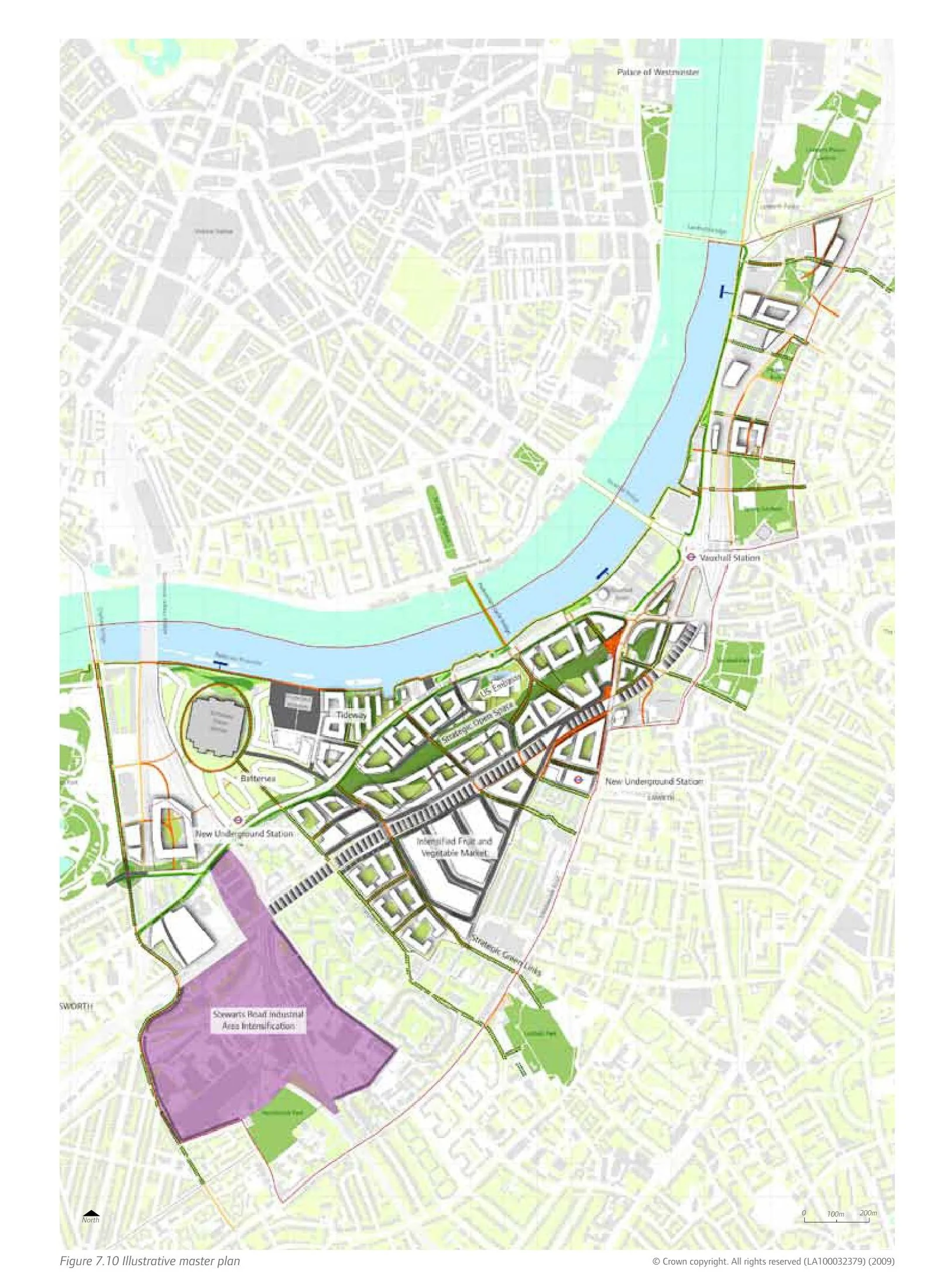
Core idea
Linear high-density mixed-use corridor incl. Battersea Power Station
Why it matters
Major central London brownfield transformation with new Northern Line extension
Description
An opportunity area planning framework adopted in 2012 by the Greater London Authority with the boroughs of Wandsworth and Lambeth, covering a linear stretch of the Thames south bank from Vauxhall through Nine Elms to Battersea. It organises one of central London's largest brownfield transformations around a high-density, mixed-use corridor anchored by the restored Battersea Power Station, a relocated United States Embassy, a linear park and an extension of the Northern line funded partly through development contributions. The framework sets capacity for tens of thousands of homes and jobs across formerly industrial riverside land.
Significance
VNEB became the emblematic case of London's opportunity-area model, in which strategic densification is tied to developer-funded infrastructure. It has been widely debated for its cluster of luxury towers, the affordability of its housing and its reliance on overseas investment, making it a touchstone in arguments over who benefits from large-scale regeneration. The Northern line extension established a much-cited precedent for financing transit through land value capture.
What shaped it
- Transit-oriented development (TOD) (1993)
- The compact city (1973-1990s)
- The skyscraper (1885)
- The metro / underground railway (1863)
- Global financial crisis (2007–2009)
Plans it influenced
- Nine Elms Linear Park (2012)
Sources
- https://www.wandsworth.gov.uk/media/5202/e18_vneb_oapf_2012.pdf
- https://www.london.gov.uk/programmes-strategies/planning/implementing-london-plan/londons-opport