Babylon (Neo-Babylonian)
Core idea
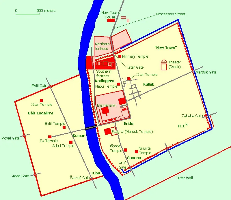
Gridded imperial capital astride the Euphrates — Processional Way, Ishtar Gate, Etemenanki ziggurat, and double fortification walls
Why it matters
The archetypal ancient mega-capital; its axial processional planning and monumental gateways influenced imperial urbanism across the Near East
Description
Under Nebuchadnezzar II (r. 605–562 BCE), Babylon was rebuilt as the largest city on Earth, straddling the Euphrates within massive double walls pierced by gates named for gods. A processional way paved in stone ran from the glazed-brick Ishtar Gate to the Etemenanki ziggurat — the likely source of the Tower of Babel story — staging the New Year festival as an urban-scale ritual. The city fused a loosely orthogonal street fabric with monumental religious and royal armatures, and its fame (and the legendary Hanging Gardens) made it a byword for the great city for millennia.
Significance
Babylon established the template of the imperial mega-capital: axial processional planning, monumental gateways, and architecture as propaganda. It shows urban form deployed deliberately to overwhelm the visitor and broadcast a dynasty's power and piety — a logic later echoed from Rome to Washington to Astana.
What became of it
Built largely as intended by Nabopolassar and Nebuchadnezzar II; declined after the Achaemenid conquest (539 BCE) and was progressively abandoned through the Seleucid/Parthian periods. Heavily damaged by 20th-century looting and a controversial Saddam-era reconstruction over original strata.
Critique
Scholars caution that famous monumental dimensions derive heavily from Herodotus and partial German excavations, so much of the 'planned grid' and population estimates are reconstructive rather than securely excavated.
What shaped it
- The grid (c. 2500 BCE)
- The ziggurat / temple-platform (c. 3000 BCE)
- Code of Hammurabi — building law (c. 1754 BCE)
- Bronze and iron metallurgy (Bronze c. 3300 BCE / Iron from c. 1200 BCE)
- Sumerian city-states and kingship (c. 3000 BCE)
Plans it influenced
- Baghdad (Round City of al-Mansur) (762)
- Constantinople (Byzantine) (330 CE)