El Mirador
Core idea
A massive Preclassic Maya city of triadic temple complexes linked by raised causeways across the rainforest.
Why it matters
Pushes planned, monumental Maya urbanism back into the Preclassic and reveals a causeway-linked metropolitan landscape.
Description
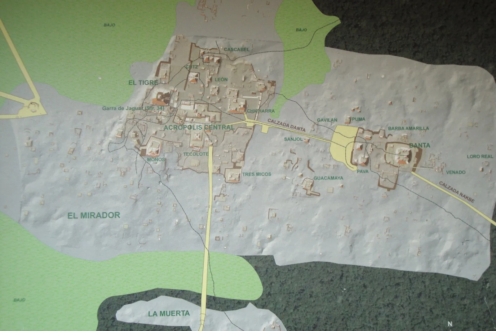
El Mirador lies in the dense rainforest of northern Petén, Guatemala, a major Middle and Late Preclassic Maya settlement that reached its peak between about 300 BCE and 150 CE. Its architecture is dominated by triadic complexes: large tiered platforms each crowned by three pyramids, the central one flanking a courtyard, with around thirty-five such groups across the site. The colossal La Danta complex, by volume among the largest structures of the ancient world, anchors the eastern edge and is joined to the centre by a monumental sacbé causeway. A network of raised stone causeways, some twenty to fifty metres wide, linked El Mirador to neighbouring centres such as Nakbé and El Tintal.
Significance
El Mirador demonstrates that large-scale planned monumental urbanism and inter-site causeway networks existed among the Maya centuries before the Classic period. Its triadic complexes and the immense La Danta show advanced engineering, labour mobilisation and ceremonial planning in the Preclassic. The site is pivotal for revising the chronology of Maya state formation and for understanding early causeway-linked metropolitan landscapes.
What became of it
Flourished in the Late Preclassic with massive triadic complexes (e.g. La Danta) and causeways; largely collapsed/abandoned around 150 CE, with only partial Classic reoccupation, then absorbed by jungle until modern rediscovery.
Critique
Richard Hansen's very high population and 'kingdom/state' claims have been criticised as over-extrapolated from LiDAR and tied to conservation-advocacy agendas.
What shaped it
- The ziggurat / temple-platform (c. 3000 BCE)
- Agriculture and the Neolithic revolution (from c. 9500 BCE)
Plans it influenced
- Tikal (c. 4th c. BCE–900 CE)
- Chichén Itzá (c. 600–1200 CE)