Freiburg Vauban
Core idea
Car-light eco-district
Why it matters
Pioneer of family-friendly eco-urbanism
Description
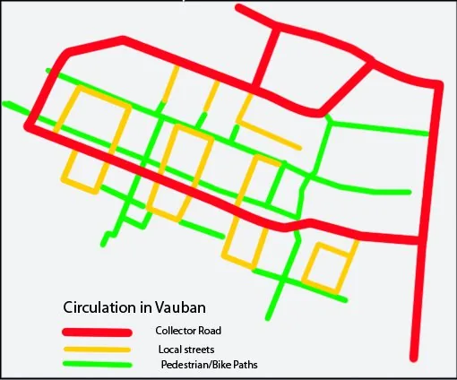
Freiburg's Vauban district (from 1993), built on a former barracks, became a model car-reduced eco-neighbourhood: residents largely park at the edges, while solar 'plus-energy' housing, district heating, tram access, and green courtyards structure daily life.
Significance
Vauban is among the world's most influential sustainable neighbourhoods, demonstrating that a low-car, energy-positive, community-led district is achievable at scale. It is a standard reference for green urbanism.
What became of it
Realised on a former French barracks as a car-light, low-energy district; widely regarded as a successful eco-neighbourhood and a frequent international reference case.
Critique
Some scholars note its relatively affluent, self-selecting residents limit how transferable its 'car-free' success is to mainstream housing.
What shaped it
- Rio Earth Summit (1992)
- Sustainable development (Brundtland) (1987)
- Ecology (1866 / 1935)
- The pedestrian zone (1953)
Plans it influenced
- Grenoble Presqu’île (2010s–)
- Quebec City Vision 2030 (2015)
- Bordeaux Bastide–Niel (2010s–)
- Edmonton Blatchford Redevelopment (former airport) (2014–)
- Malmö Western Harbour / Bo01 (2001–)