Greater Cairo Master Scheme
Core idea
Desert satellites, ring roads
Why it matters
Long-term decongestion strategy
Description
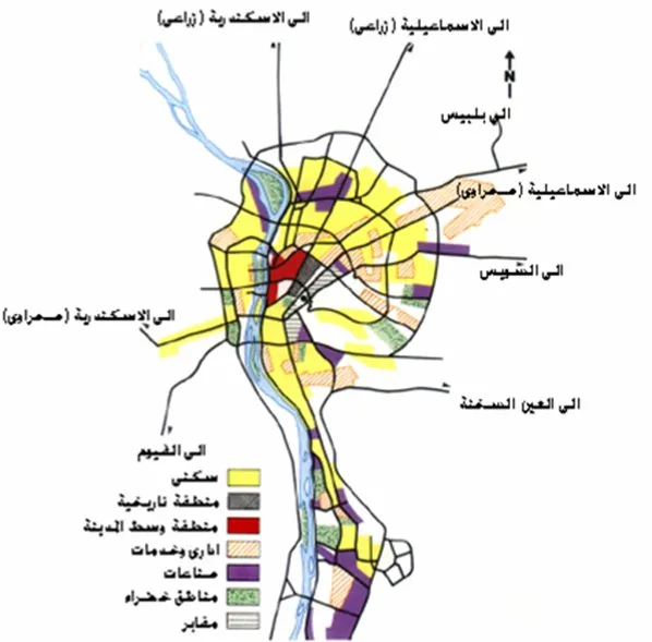
The Greater Cairo Master Scheme of the 1970s, prepared by Egypt's General Organization for Physical Planning, set a long-term strategy for a metropolis growing far beyond its Nile valley core. Its central moves were the creation of new satellite towns in the surrounding desert, ring roads to structure and bypass the agglomeration, and the protection of scarce agricultural land in the valley and delta from further encroachment.
Significance
The scheme launched Egypt's enduring desert new-towns policy, from which settlements such as 6th of October and 10th of Ramadan derive, making it one of the most consequential decongestion strategies in the Arab world. The persistent gap between the planned satellites and Cairo's actual informal growth on farmland has made it a central case in debates about desert urbanisation and state capacity in metropolitan planning.
What shaped it
- The master plan (early 20th c.)
- The urban freeway (mid-20th c.)
- Ekistics (1968)
Plans it influenced
- Cairo 2050 (proposal) (2010)
- 6th of October City Master Plan (Egypt) (1979)
- Sheikh Zayed City Master Plan (Egypt) (1993)
Sources
- https://en.wikipedia.org/wiki/Greater_Cairo_Planning_Commission
- https://shs.hal.science/halshs-01755844/document