Heian-kyō (Kyoto)
Core idea
Orthogonal imperial plan
Why it matters
Basis for Kyoto’s later fine-grain urbanism
Description
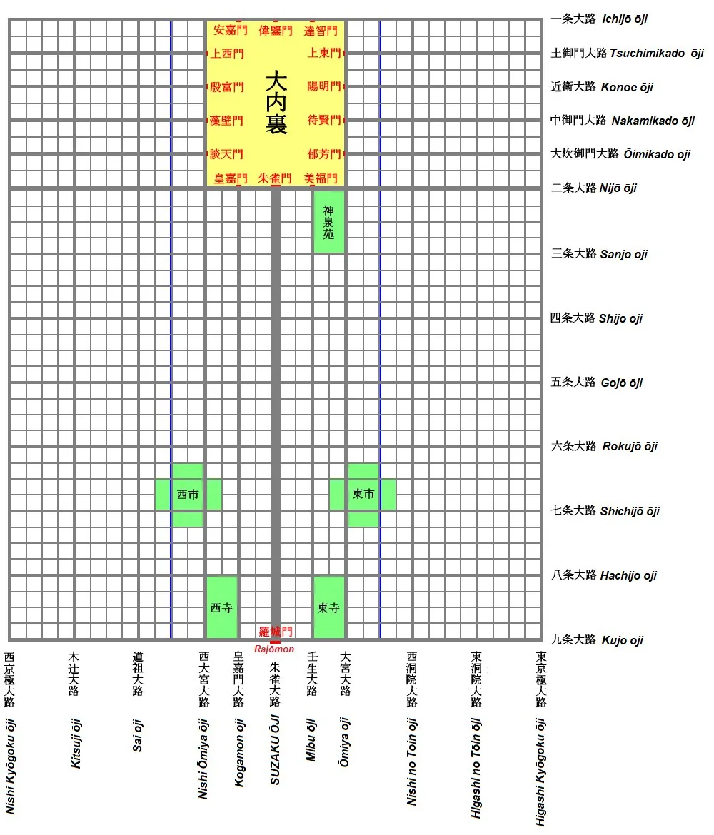
Heian-kyō, founded in 794 CE on the site of present-day Kyoto, was laid out by the Japanese imperial court as a new capital following the Chinese model already used at Nara. The plan was a large rectangular grid of avenues and streets aligned to the cardinal directions, with the imperial palace enclosure at the north end of the central Suzaku Avenue and the city divided into regulated wards for aristocrats, commoners, markets and temples.
Significance
Heian-kyō remained the imperial capital of Japan for over a thousand years, and its original grid became the armature for Kyoto's celebrated fine-grain urbanism of machiya townhouses, subdivided blocks and incremental adaptation. It shows how a single cosmological plan can absorb centuries of transformation while continuing to structure everyday urban life, making it a central case in East Asian planning history.
What became of it
Only partly realised: the marshy western half (Ukyo) was largely abandoned while the eastern half thrived, and the grid gradually deformed over centuries, but the plan still underlies modern central Kyoto.
Critique
Scholars note the rigid Chinese-derived grid ignored local hydrology, dooming the western capital and revealing the limits of importing the Chang'an model wholesale.
What shaped it
- The walled-ward (fang) city system (Sui–Tang, c. 6th–9th c.)
- Fengshui landscape cosmology (Han onward, codified by Song)
- The grid (c. 2500 BCE)
- Kaogongji (Artificers' Record) (c. 5th c. BCE)
Plans it influenced
- Kamakura (Bakufu Capital) (1180)
- Dadu (Yuan Beijing) (1267)