Historic Town of Sukhothai
Core idea
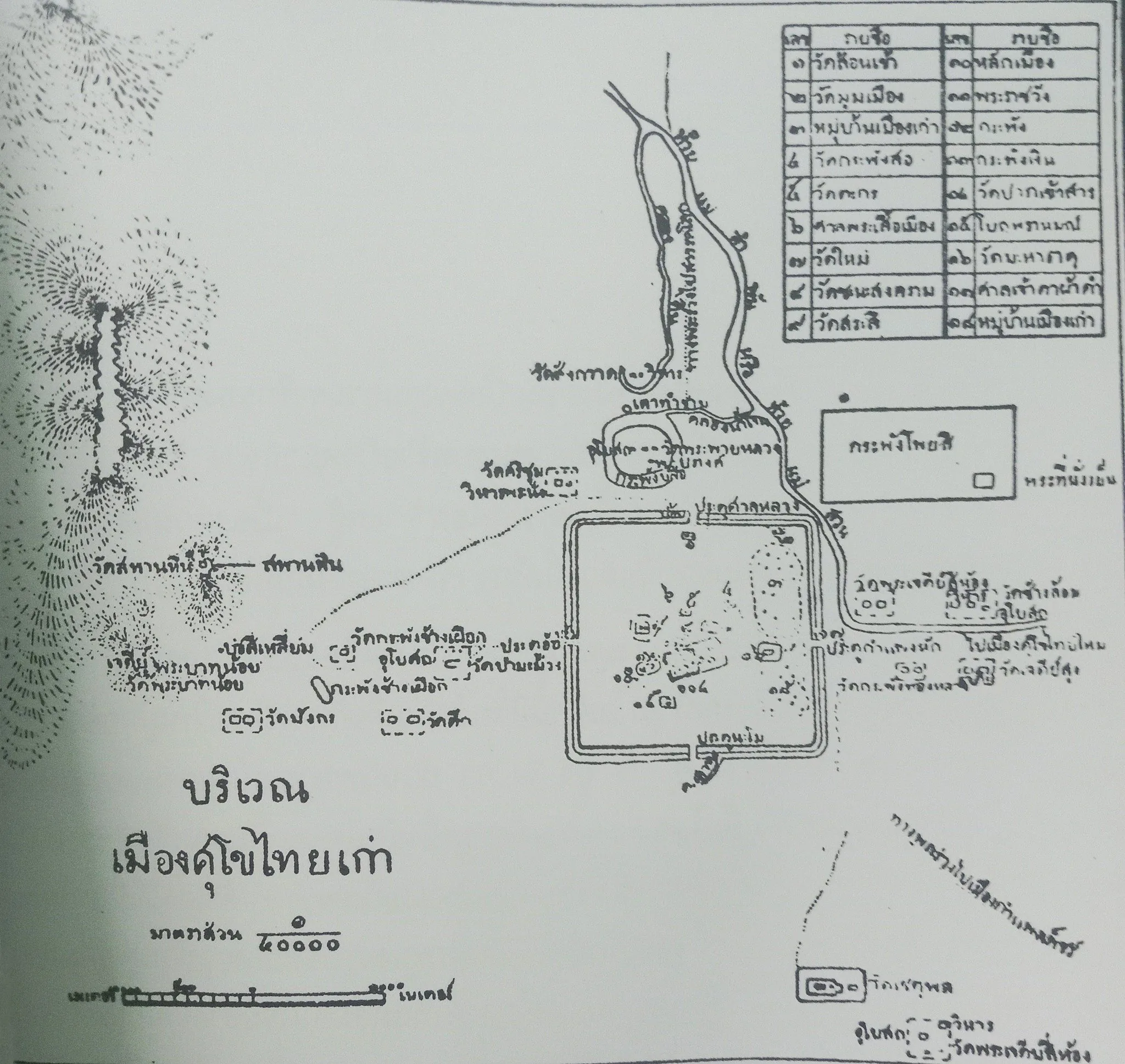
The first Thai capital: a rectilinear moated and walled royal city with an axial temple zone and hydraulic planning.
Why it matters
Established a foundational template of moated, water-managed royal city form in Thai urban tradition.
Description
Sukhothai, in north-central Thailand, was the capital of the first independent Thai kingdom, emerging as a polity in 1238 under Si Inthrathit and reaching its cultural height under King Ramkhamhaeng later that century. The city is laid out as a rectangle roughly two kilometres east-west, ringed by earthen ramparts and concentric moats that served both defence and water supply. Within the walls, monumental temple complexes dominated by Wat Mahathat occupy a central ceremonial zone, surrounded by shrines, ponds and residential areas. The kingdom's planners were accomplished hydraulic engineers, damming watercourses and building reservoirs, ponds and canals to control flooding and serve agricultural, ritual and everyday urban needs.
Significance
Sukhothai established an enduring template of the Thai royal city: a moated, walled rectangle with a central temple precinct and sophisticated water management. As the cradle of Siamese architecture, writing and Theravada statecraft, it shaped later Thai urban and cultural traditions. Its integration of hydraulic engineering with ceremonial planning makes it a key reference for moated city form in mainland Southeast Asia.
What shaped it
- Buddhism (c. 5th c. BCE)
- The chakravartin universal-king ideal (c. 4th c. BCE onward)
Plans it influenced
- Luang Prabang Royal City (c. 1353)
- Vientiane (Lan Xang Capital) (1563)