Kuwait Madinat al-Hareer (Silk City) Plan
Core idea
Northern mega-city and causeway-linked hub
Why it matters
Blueprint for national-scale diversification
Description
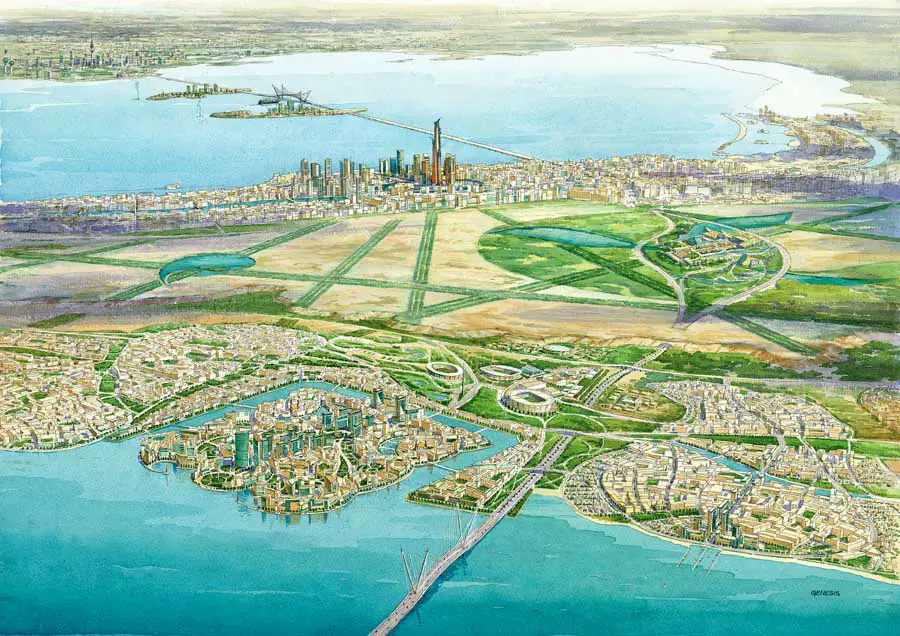
Madinat al-Hareer, or Silk City, is a proposal launched from 2006 by the Kuwaiti government with masterplanning input from SSH and other consultants for a vast new city in the Subiya area of northern Kuwait, across the bay from Kuwait City. Conceived as a national-scale economic diversification project, it envisaged a mixed-use metropolis for hundreds of thousands of residents, anchored by port, trade and leisure functions and linked to the capital by the Sheikh Jaber Al-Ahmad Causeway. The scheme became associated with proposals for an extremely tall landmark tower, the Burj Mubarak al-Kabir, as a symbol of national ambition.
Significance
Silk City exemplifies Gulf state-capitalist megaproject urbanism, in which city-building is deployed as an instrument of post-oil economic strategy and regional geopolitics, here tied to China's Belt and Road ambitions. Its slow and partial realisation, with the causeway completed while most of the city remains unbuilt, has made it a reference point in debates about the feasibility and governance of announced mega-cities in the region.
What shaped it
- Neoliberalism (1970s–1990s)
- Splintering Urbanism (Graham & Marvin) (2001)
- The skyscraper (1885)