NYC Commissioners’ Plan (Manhattan Grid)
Core idea
Rectangular grid for expansion
Why it matters
Enables massive speculative, legible growth
Description
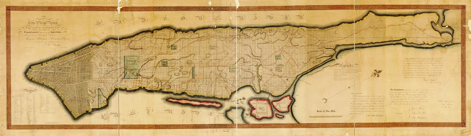
The 1811 Commissioners' Plan imposed a relentless rectangular grid of numbered streets and avenues across the whole of undeveloped Manhattan, with almost no squares or diagonals, prioritizing the easy survey, sale, and development of land parcels over monumental or picturesque effect.
Significance
The Manhattan grid is the world's most famous example of the city as a real-estate machine — speculation rendered as geometry. Endlessly criticized and endlessly productive, it shaped how Americans imagine urban order and proved astonishingly adaptable.
What became of it
Adopted in 1811, the grid was extended over the whole of Manhattan above Houston Street as the city grew, becoming the dominant framework of the borough; only later interventions such as Central Park departed from it.
Critique
Critics from Olmsted onward charged that the relentless grid ignored topography, provided almost no public open space, and treated land purely as a speculative commodity.
What shaped it
- Commissioners' Plan grid (1811)
- The grid (c. 2500 BCE)
- The Wealth of Nations (1776)
- The Enlightenment (18th c.)
Plans it influenced
- NYC Zoning for Quality & Affordability / Mandatory Inclusionary Housing (2016)
- Adelaide (Light’s Plan) (1837)
- Battery Park City Master Plan (NYC) (1979)
Sources
- https://en.wikipedia.org/wiki/Commissioners'_Plan_of_1811
- https://thegreatestgrid.mcny.org/the-1811-plan