NYC PlaNYC / OneNYC
Core idea
Sustainability + resilience agenda
Why it matters
Blueprint for mega-city climate action
Description
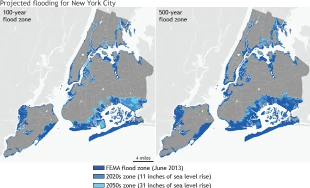
New York's PlaNYC (2007), continued as OneNYC, was a comprehensive long-term sustainability and resilience plan setting targets for emissions, parks, housing, and — especially after Hurricane Sandy — coastal climate adaptation across the five boroughs.
Significance
PlaNYC mainstreamed climate resilience and sustainability into the governance of a major world city, becoming an influential template for municipal climate-action and adaptation planning globally.
What became of it
Realised as an ongoing strategic framework, evolving from PlaNYC (2007) into OneNYC (2015) and later updates; several targets (the million trees, emissions cuts) were met while it institutionalised sustainability and resilience planning across city agencies.
Critique
Criticised as long on aspiration and metrics but uneven in delivery, with equity and resilience outcomes lagging the headline environmental goals.
What shaped it
- Sustainable development (Brundtland) (1987)
- Hurricane Katrina (2005)
- Degrowth (2008)
- Kyoto Protocol (1997)
Plans it influenced
- NYC Zoning for Quality & Affordability / Mandatory Inclusionary Housing (2016)
- Los Angeles Mobility Plan 2035 (2015)
- Bay Area Plan Bay Area 2050 (2021)
- Boston Imagine Boston 2030 (2017)
- Philadelphia Green City, Clean Waters (2011)
- Paris Resilience Strategy & 15-minute city policies (2020–)
Sources
- https://en.wikipedia.org/wiki/PlaNYC
- https://www.cakex.org/case-studies/planyc-onenyc-comprehensive-sustainability-plan-new-york-city