Quanzhou (Zayton, Song-Yuan Maritime Emporium)
Core idea
Multi-religious river-sea trade city whose spatial structure bound production, transport and marketing under maritime-trade bureaux
Why it matters
The leading port of Song-Yuan China and a model of mercantile, institutionally governed maritime urbanism
Description
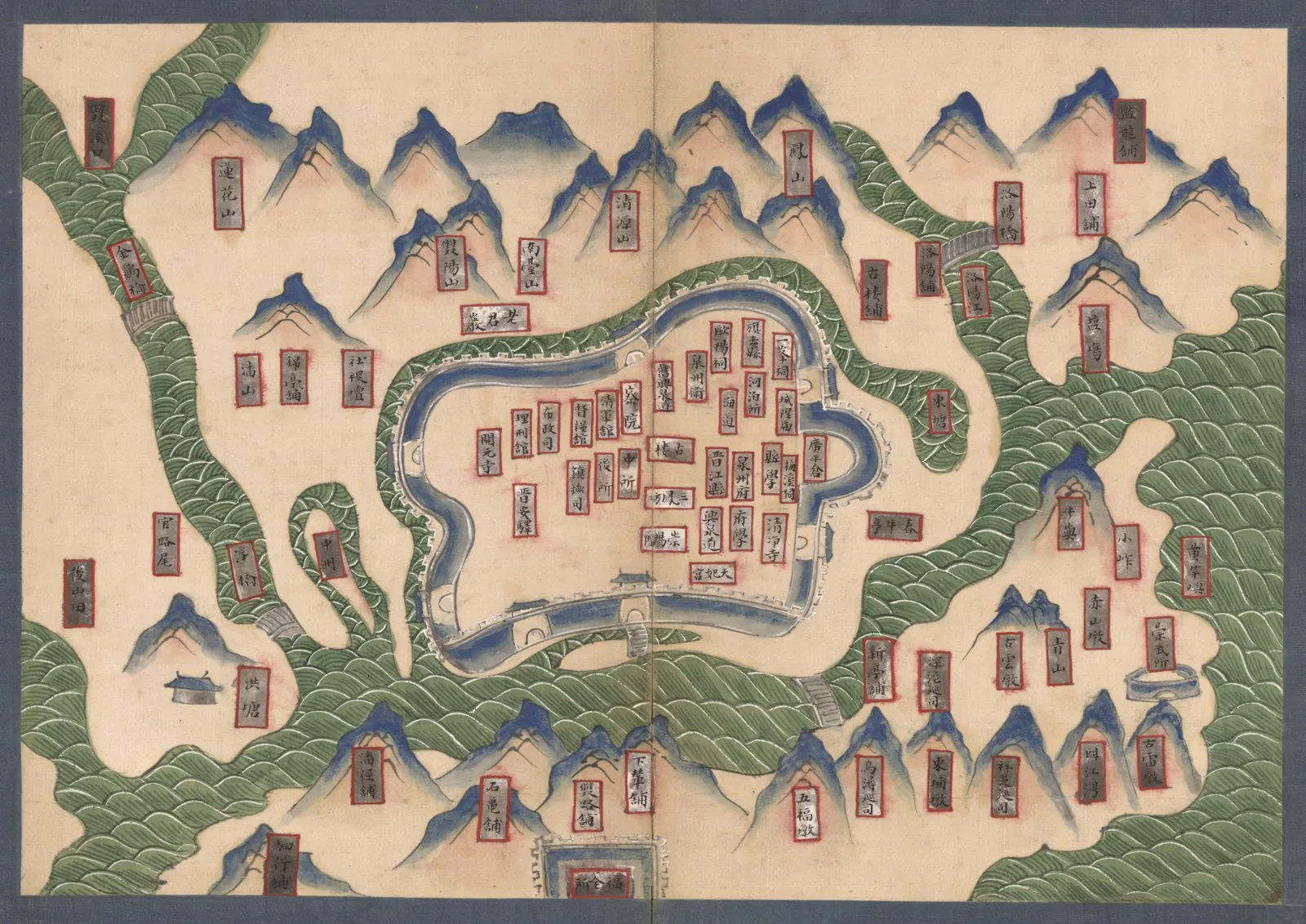
On the south-eastern coast of Fujian, Quanzhou — known to Arab and Western traders as Zayton — became the foremost maritime port of Song and Yuan China, hailed as the 'Emporium of the World'. The establishment of a Maritime Trade Bureau in 1087 formalised state administration of overseas commerce, and the city grew into a vast emporium linking the Chinese hinterland to roughly a hundred ports across the Indian Ocean. Its spatial structure integrated administrative buildings, walls, gates and roads with ceramic and iron production sites, stone docks, bridges and pagoda landmarks, while merchant communities from Persia, Arabia and India sustained Islamic, Hindu, Christian and Buddhist institutions in a notably cosmopolitan urban fabric.
Significance
Quanzhou exemplifies a trade-administered maritime city rather than a cosmologically planned imperial capital, organising its territory around commerce, production and a multi-faith population. Inscribed by UNESCO in 2021 as a serial property of twenty-two sites, it stands as the paradigmatic East Asian emporium of the medieval Maritime Silk Road, demonstrating how bureaucratic institutions and port infrastructure could structure a major city's growth.
What became of it
Flourished as one of the world's busiest seaports under the Song and Yuan (known abroad as Zayton), a starting point of the Maritime Silk Road; it declined from the late 14th century (Ming maritime restrictions, silting, political change) and was eclipsed by other ports, though its multi-religious monuments survive and were inscribed as a UNESCO World Heritage site in 2021.
Critique
The famous 500,000 figure derives largely from medieval travellers' accounts (e.g. Marco Polo, Ibn Battuta) and is regarded as impressionistic rather than a verified census.
What shaped it
- Magnetic compass for navigation (11th c.)
- The Grand Canal and the canal city (Sui unification 605–609; extended to 1293)
- The walled-ward (fang) city system (Sui–Tang, c. 6th–9th c.)
- Fengshui landscape cosmology (Han onward, codified by Song)
- The baojia mutual-responsibility registration (Northern Song, c. 1070)
Plans it influenced
- Hangzhou (Southern Song Capital) (1138)
- Dadu (Yuan Beijing) (1267)