Recife Parque Capibaribe
Core idea
Green-blue linear park system
Why it matters
Nature-based urbanism in tropical city
Description
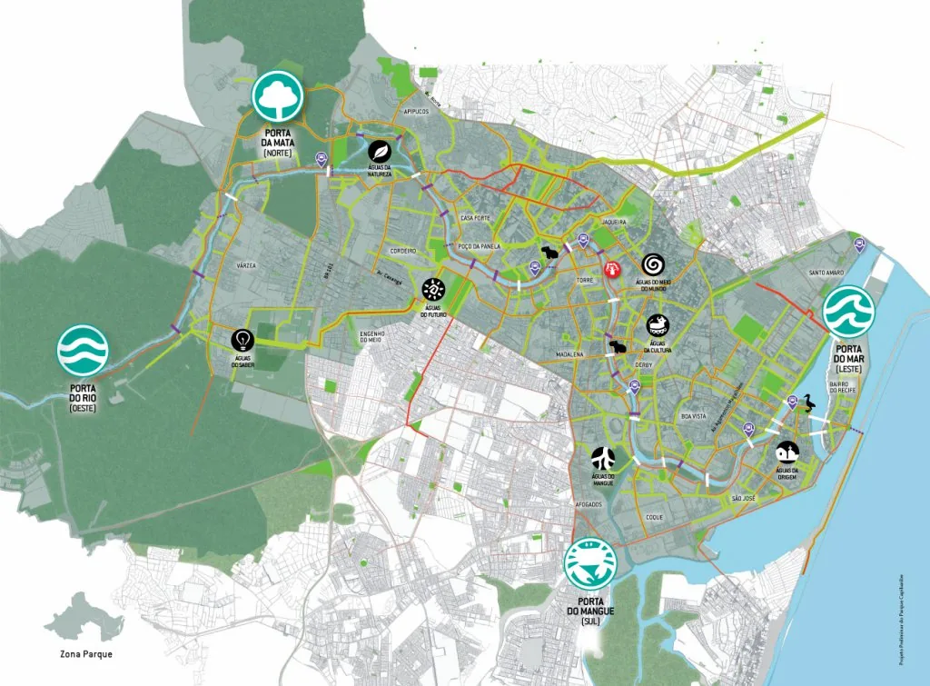
Recife's Parque Capibaribe (from 2012) is a long-term plan to transform the Brazilian city around its rivers, creating a connected network of parks and green corridors to reconnect residents to the water and build climate resilience in a flood-prone delta.
Significance
Parque Capibaribe is a leading Latin American example of river-led, ecological urban transformation, reimagining a flood-vulnerable city as a 'city-park' adapted to water rather than walled off from it.
What became of it
Partly realised: pilot stretches, parks and waterfront promenades have been delivered, but the full 'park city' vision is a long-term, incrementally implemented programme.
Critique
Implementation has been slow and dependent on shifting municipal priorities and funding, leaving much of the river corridor untransformed.
What shaped it
- The linear park / greenway (1878 / 2009 revival)
- Landscape urbanism (Waldheim) (1997-2006)
- Urban resilience (2013)
- Brazil's City Statute (Estatuto da Cidade) (2001)
- Ecology (1866 / 1935)
Plans it influenced
Sources
- https://inciti.org/projeto/parque-capibaribe/
- https://liveprojectsnetwork.org/project/parque-capibaribe/