Salisbury (New Sarum)
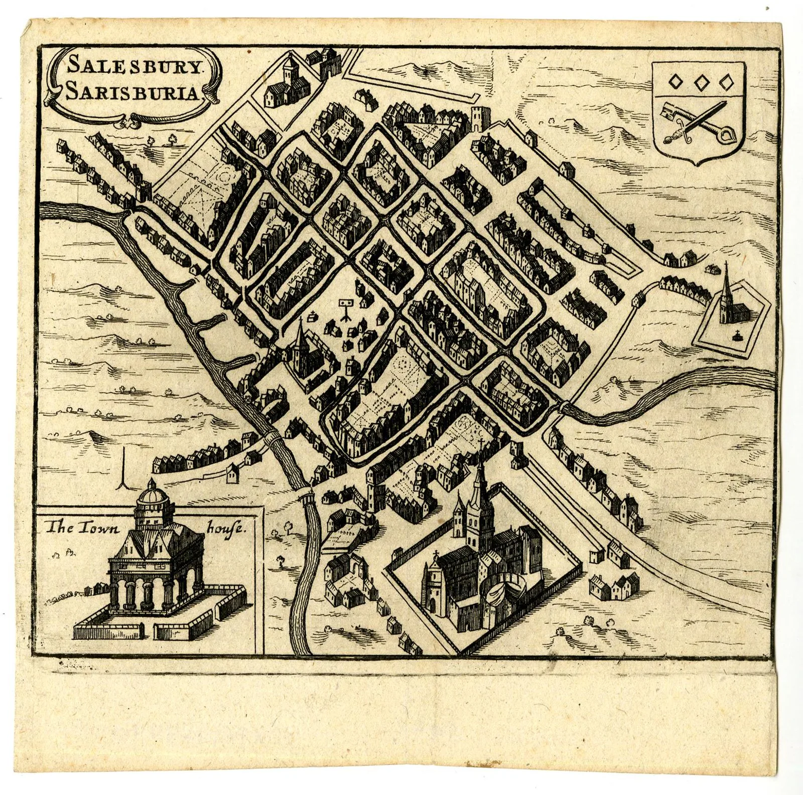
Core idea
Planned cathedral city laid out on a regular grid of "chequers" (blocks) on the plain below abandoned Old Sarum, with a vast cathedral close and market square
Why it matters
England's great planned medieval new town; shows ecclesiastical city-founding and the deliberate relocation of an entire community to a rational gridded site
Description
Salisbury, or New Sarum, was laid out from 1220 under Bishop Richard Poore, when cathedral and community were moved from the cramped hilltop of Old Sarum to a fresh site on the plain below. The new city was organised on a regular grid of rectangular blocks known as chequers, with water channels along the streets, a spacious market square, and a vast walled cathedral close containing the new cathedral. It was an ecclesiastical foundation planned and developed as a single coherent enterprise.
Significance
Salisbury is England's outstanding planned medieval new town and a key example of church-led city-founding, notable for the deliberate relocation of an entire community to a rationally gridded site. It is regularly invoked in accounts of medieval town plantation to show that gridded, regulated urban design was a routine instrument of thirteenth-century lordship and enterprise.
What shaped it
- Magna Carta (1215)
- Feudalism and manorialism (c. 9th–15th centuries)
- Gothic rib-vault and flying buttress (12th c.)
Plans it influenced
- Aigues-Mortes (1240s)
- Caernarfon (1283)