Tokyo Otemachi–Marunouchi–Yurakucho (OMY) District Plan
Core idea
Incremental high-density redevelopment with urban design codes
Why it matters
Model of long-horizon district governance
Description
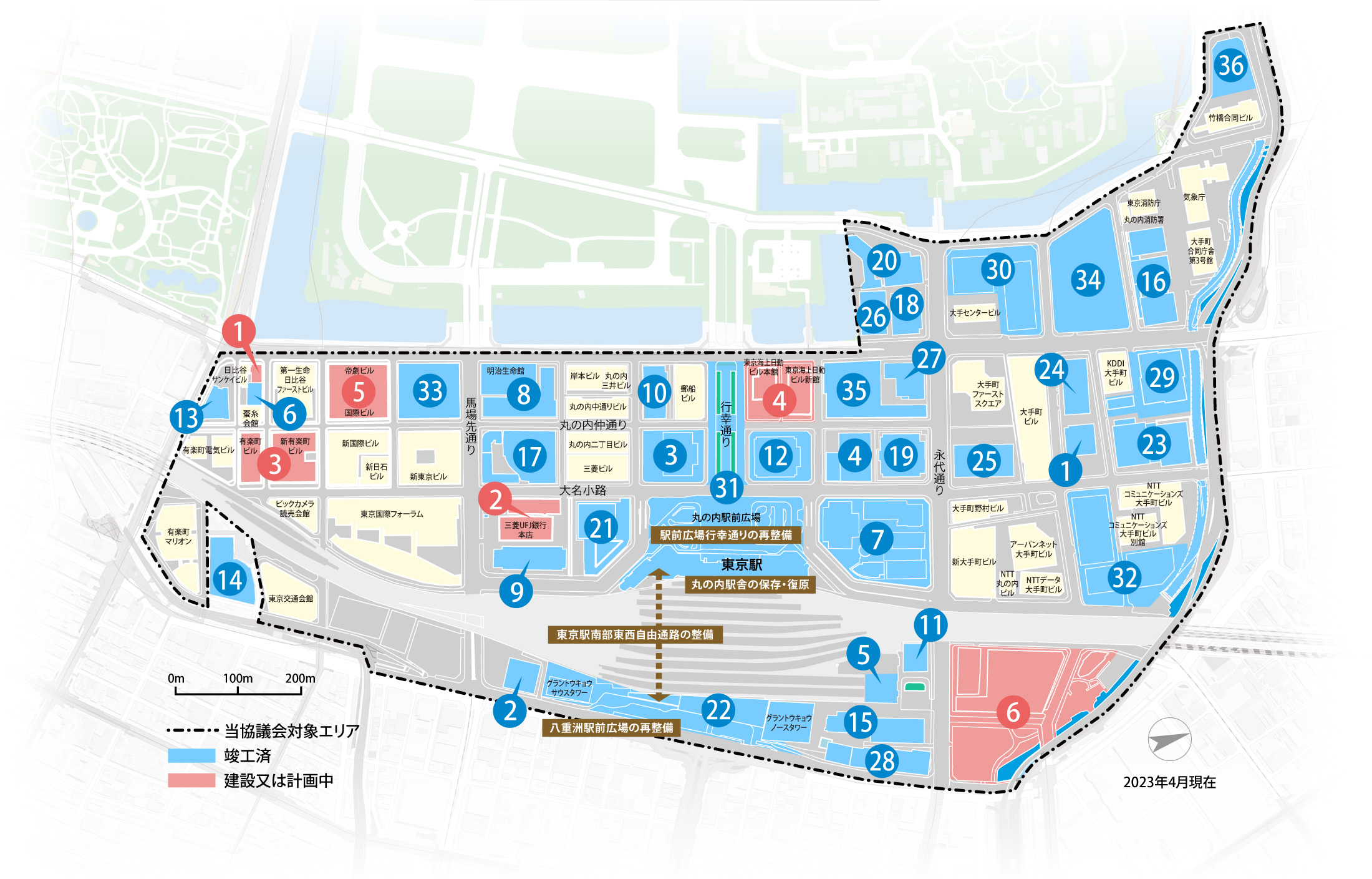
The Otemachi–Marunouchi–Yurakucho District Plan governs the incremental redevelopment of Tokyo's principal business district beside the Imperial Palace and Tokyo Station. Steered from 1998 by a council bringing together major landowner Mitsubishi Estate, Chiyoda Ward, the metropolitan government and railway interests, it uses shared urban design guidelines, floor-area transfer mechanisms and ground-level design codes to rebuild the district block by block at higher densities while improving streets, skyline coherence and public space.
Significance
OMY is regarded as a model of long-horizon district governance, in which private landowners and public authorities jointly manage continuous renewal over decades through negotiated codes rather than a single fixed plan. It has influenced thinking on area management organisations and incentive zoning in Japan and across East Asia.
What shaped it
- The imperial capital and the central axis (fullest form Ming Beijing, from 1420)
- The skyscraper (1885)
- Transit-oriented development (TOD) (1993)
- Delirious New York (1978)
- Asian financial crisis (1997–1998)
Plans it influenced
- Fukuoka Tenjin Big Bang (2015–)
- Tokyo Roppongi Hills Masterplan (2003)
Sources
- https://sustainable.japantimes.com/unraveling/12
- https://www.tokyo-omy-council.jp/en/area/redevelopment-map/