DMIC Regional Plan
Core idea
Industrial corridor with nodes
Why it matters
Megaregional industrial urbanization
Description
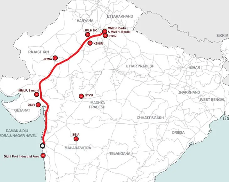
The Delhi–Mumbai Industrial Corridor (DMIC) Regional Plan, launched by the Government of India through the Delhi Mumbai Industrial Corridor Development Corporation from 2007, is a megaregional strategy structured along the dedicated freight rail corridor linking the two metropolises. Rather than a single city plan, it strings a series of new industrial nodes, investment regions and greenfield smart cities—Dholera in Gujarat being the most prominent—along the corridor's spine, combining logistics infrastructure, industrial estates and planned urban settlements. The plan operates at a scale spanning several states, with node-level master plans prepared by international consultancies under central–state partnership arrangements.
Significance
The DMIC exemplifies the twenty-first-century turn towards corridor urbanism at the megaregional scale, in which industrial policy, freight logistics and city-building are fused into a single spatial project. It has become a reference point in debates about India's urban future, praised as a framework for organising industrial urbanisation and criticised for land-acquisition conflicts, slow delivery and the speculative character of its greenfield nodes.
What shaped it
- The master plan (early 20th c.)
- Neoliberalism (1970s–1990s)
- Containerised-logistics scale-up (1970s–1990s)
Plans it influenced
- Dholera SIR (2009–)
- GIFT City, Gandhinagar (2007–)
Sources
- https://www.dpiit.gov.in/programmes-and-schemes/delhi-mumbai-industrial-corridordmic
- https://nicdc.in/projects/national-industrial-corridor-development-programme/delhi-mumbai-indust
- https://www.orfonline.org/research/infrastructure-institutions-and-industrialisation-the-delhi-m