Postwar & Welfare-Modernist (1945–1975)
Islamabad
Core idea
Sectoral ‘dynapolis’, hierarchical roads
Why it matters
Planned capital for a new state
Description
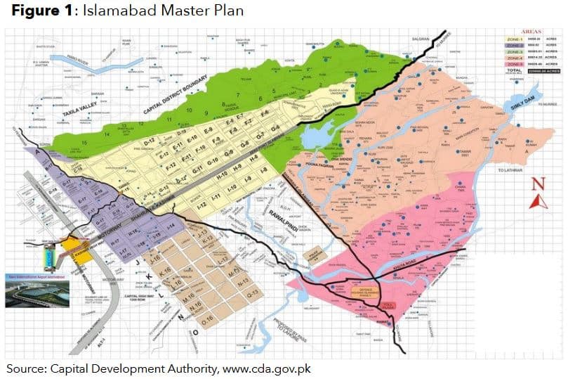
Constantinos Doxiadis's 1960 plan for Islamabad created a new Pakistani capital on a grid of self-contained sectors, designed for 'dynapolis' — open-ended directional growth — and separated from the existing city of Rawalpindi, with a monumental administrative core.
Significance
Islamabad is a major example of postcolonial capital-building and of Doxiadis's 'ekistics,' demonstrating the mid-century faith that a rationally planned new capital could embody a young nation's modern aspirations.
What shaped it
- The master plan (early 20th c.)
- The Neighbourhood Unit (1929)
- The urban freeway (mid-20th c.)
Plans it influenced
- Abuja Master Plan (1979)
- Lahore Master Plan (1966)
- Sejong Special Self-Governing City (2012–)
- Egypt New Administrative Capital (NAC) (2015–)
- 6th of October City Master Plan (Egypt) (1979)
- Putrajaya Masterplan (Malaysia) (1993–)
- Astana New Capital Master Plan (Kurokawa) (1998)
Sources
- https://pide.org.pk/research/the-islamabad-master-plan/
- https://www.researchgate.net/publication/342393741_The_Islamabad_Master_Plan
hub.toekom.st — History of Urbanism · an interactive timeline of 850 planned cities across 6,000 years.