Jaipur
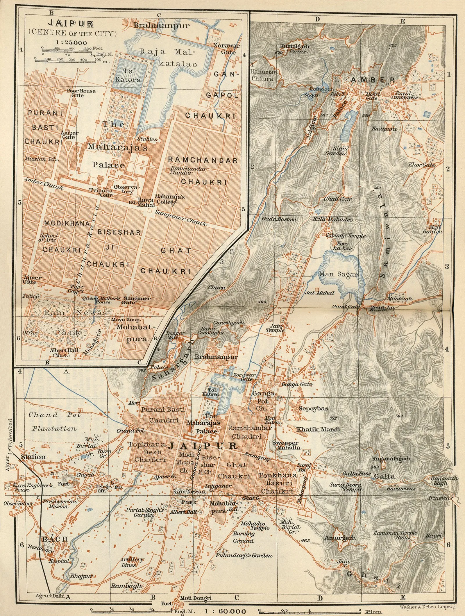
Core idea
Nine-square mandala grid with bazaars/chowks
Why it matters
Early climate-savvy planned city of India
Description
Founded in 1727 by Maharaja Sawai Jai Singh II, Jaipur was one of the first planned cities of early-modern India, laid out on a nine-block grid derived from the Hindu mandala and the Vastu Shastra, adapted around the terrain. Wide straight bazaar streets, uniform shopfronts, color-washed façades, and an integrated palace-and-observatory complex (the Jantar Mantar) combined cosmological order with commercial and astronomical ambition.
Significance
Jaipur shows indigenous South Asian planning theory producing a rational, regulated city on the eve of colonialism — proof that the 'planned city' was not a European import. Its mandala grid, design controls, and surviving coherence make it a touchstone for Indian urbanism and a model the British later studied.
What became of it
Realised as the planned Pink City and continuously inhabited; the nine-square grid and its bazaars survive as the core of modern Jaipur, now home to over 3 million people, and are UNESCO-listed.
What shaped it
- Vastu Shastra / Mayamata / Manasara (c. 6th c. CE)
- The vastu-purusha mandala diagram (c. 6th c. CE (codified))
- The grid (c. 2500 BCE)
- Ottoman, Mughal and Qing imperial states (16th–18th c.)
- Hinduism & the Vedas (c. 1500 BCE onward)
Plans it influenced
Sources
- https://www.getbengal.com/details/bengali-architect-vidyadhar-bhattacharya-who-built-jaipur-indi
- https://www.cnn.com/travel/article/jaipur-india-planned-city