Kaifeng (Northern Song Capital)
Core idea
Commercial capital where the old walled-ward (fangshi) system dissolved into open streets lined with shops, restaurants, and night markets
Why it matters
Marks the birth of the open commercial street-city in China; the Qingming scroll depicts the first modern-feeling urban street life
Description
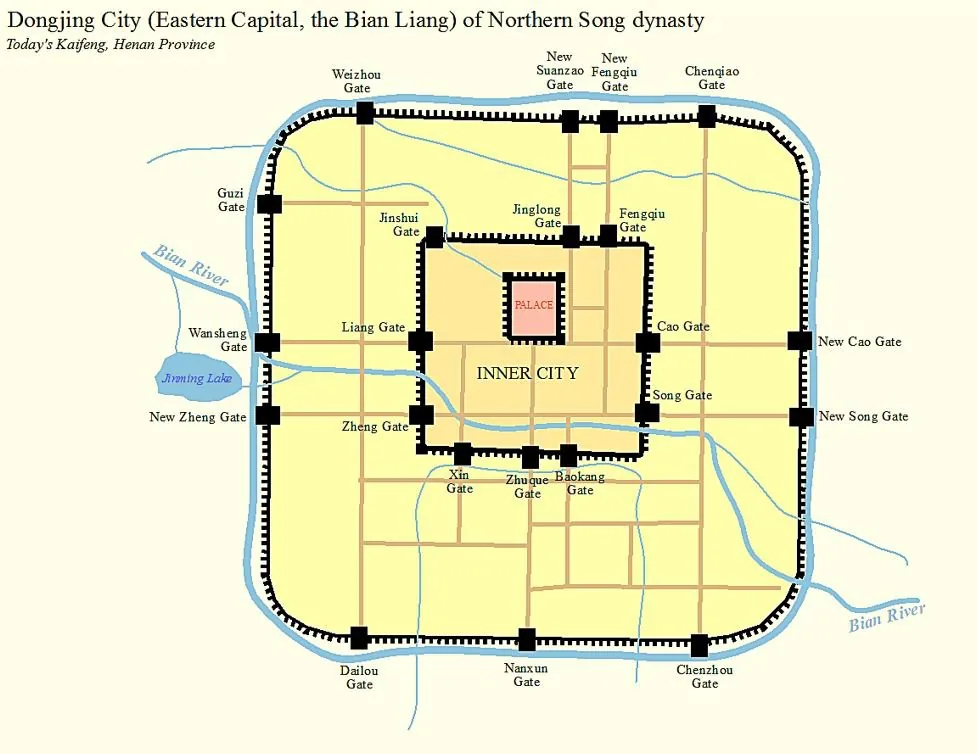
As the Northern Song capital (960–1127), Kaifeng broke decisively with the rigid walled-ward system of earlier Chinese capitals. The old curfewed, gated wards dissolved into open streets lined with shops, workshops, restaurants, and night markets along the canals — a commercial city of perhaps a million people famously depicted in the painted handscroll 'Along the River During the Qingming Festival.'
Significance
Kaifeng marks the birth of the open commercial street-city in China — the moment urban form was reorganized around trade and everyday street life rather than cosmological control. It captures a medieval commercial revolution centuries ahead of comparable shifts elsewhere.
What became of it
Kaifeng fell to the Jurchen Jin in 1127 (the Jingkang Incident), when the city was sacked and the Northern Song ended. The Song city was subsequently buried by repeated Yellow River floods, and modern Kaifeng sits atop the silted-over Northern Song layers.
Critique
The classic thesis of a 'medieval urban revolution' marked by the collapse of the enclosed fangshi ward-market system into open shop-lined streets at Kaifeng has been questioned as overstated, and the 'over one million' population rests on contested inferences from unreliable Song household registers.
What shaped it
- The walled-ward (fang) city system (Sui–Tang, c. 6th–9th c.)
- The Grand Canal and the canal city (Sui unification 605–609; extended to 1293)
- Paper and woodblock printing (7th–9th c.)
- The grid (c. 2500 BCE)
- The iron mouldboard plough (from c. 3rd c. BCE (Han refinement))
Plans it influenced
- Hangzhou (Southern Song Capital) (1138)
- Quanzhou (Zayton, Song-Yuan Maritime Emporium) (1087)
- Dadu (Yuan Beijing) (1267)
Sources
- https://en.wikipedia.org/wiki/Kaifeng
- https://afe.easia.columbia.edu/songdynasty-module/cities-new.html