Milton Keynes
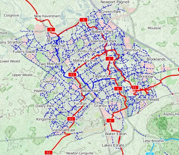
Core idea
Fast grid roads, roundabouts, linear parks
Why it matters
Flexible car-era new town at metropolitan scale
Description
Milton Keynes, designated in 1967 as the largest of Britain's new towns, was planned by the Milton Keynes Development Corporation with consultants Llewelyn-Davies, Weeks, Forestier-Walker and Bor. The plan rejected both the neighbourhood unit and the megastructure in favour of a lattice of fast grid roads defining roughly kilometre-square environmental areas, with linear parks along the valleys, a low-density dispersed form and a deliberately flexible, non-hierarchical structure open to change.
Significance
Milton Keynes represents the late, self-critical phase of the British new-towns programme, absorbing Californian ideas about mobility, choice and indeterminacy into a state-built city. Its grid and forest-city landscape have been read both as a successful accommodation of the car age and as an emblem of auto-dependent dispersal, keeping it at the centre of debates about density, flexibility and the legacy of welfare-state urbanism.
What became of it
Realised as Britain's largest and most successful new town, it has grown to roughly its planned size and continues to expand.
Critique
Its car-oriented grid produced low densities and weak public-transport viability, leaving it heavily dependent on the private car.
What shaped it
- New Towns Act (1946)
- Broadacre City (1932)
- The urban freeway (mid-20th c.)
- The master plan (early 20th c.)
- The Image of the City (1960)
- The cul-de-sac / Radburn layout (1929)
Plans it influenced
- Seoul New Towns (Bundang, Ilsan, etc.) (1990s)
- Navi Mumbai (1967)
- Almere (1976–)
Sources
- https://en.wikipedia.org/wiki/Milton_Keynes_Development_Corporation
- https://www.tandfonline.com/doi/full/10.1080/18626033.2023.2348353