Early 20th Century & the Modern Movement (1900–1945)
New Delhi (Lutyens’ Plan)
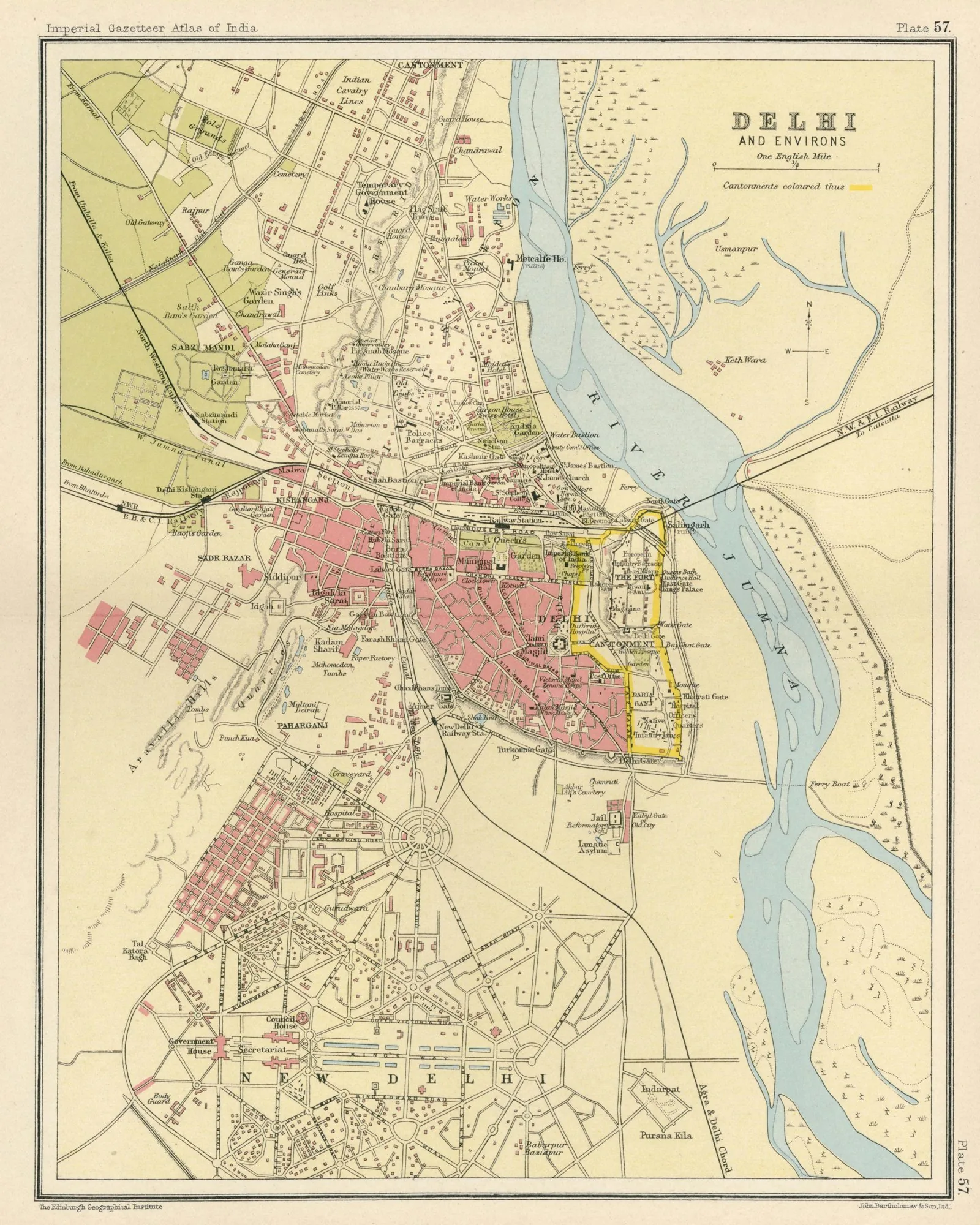
Core idea
Ceremonial axis (Rajpath), hexagonal patterns
Why it matters
Iconic imperial capital form
Description
Edwin Lutyens and Herbert Baker designed New Delhi (1911–1931) as the imperial capital of British India, with broad ceremonial avenues, hexagonal road geometries, and monumental classical-Indian government buildings arranged around the axial Rajpath leading to the Viceroy's House.
Significance
New Delhi is a culminating example of imperial capital design, projecting British power through monumental axial planning. After independence it became the seat of Indian democracy, its imperial armature repurposed for a new nation.
What shaped it
- Plan of Chicago (1909)
- The British Empire and modern colonialism (1600 – 20th c.)
- The garden suburb (1903)
- The boulevard (17th–19th c.)
Plans it influenced
- Delhi Master Plan MPD-2021 (2007)
- Delhi MPD-2041 (2021)
- Amaravati Capital City (stalled) (2015–)
- Chandigarh (1951–1965)
- Canberra (1913)
- Putrajaya Masterplan (Malaysia) (1993–)
Sources
Open it on the interactive timeline →hub.toekom.st — History of Urbanism · an interactive timeline of 850 planned cities across 6,000 years.