Tatu City Masterplan (Kenya)
Core idea
Private new city in Nairobi metro
Why it matters
Long-term decongestion via satellite urbanism
Description
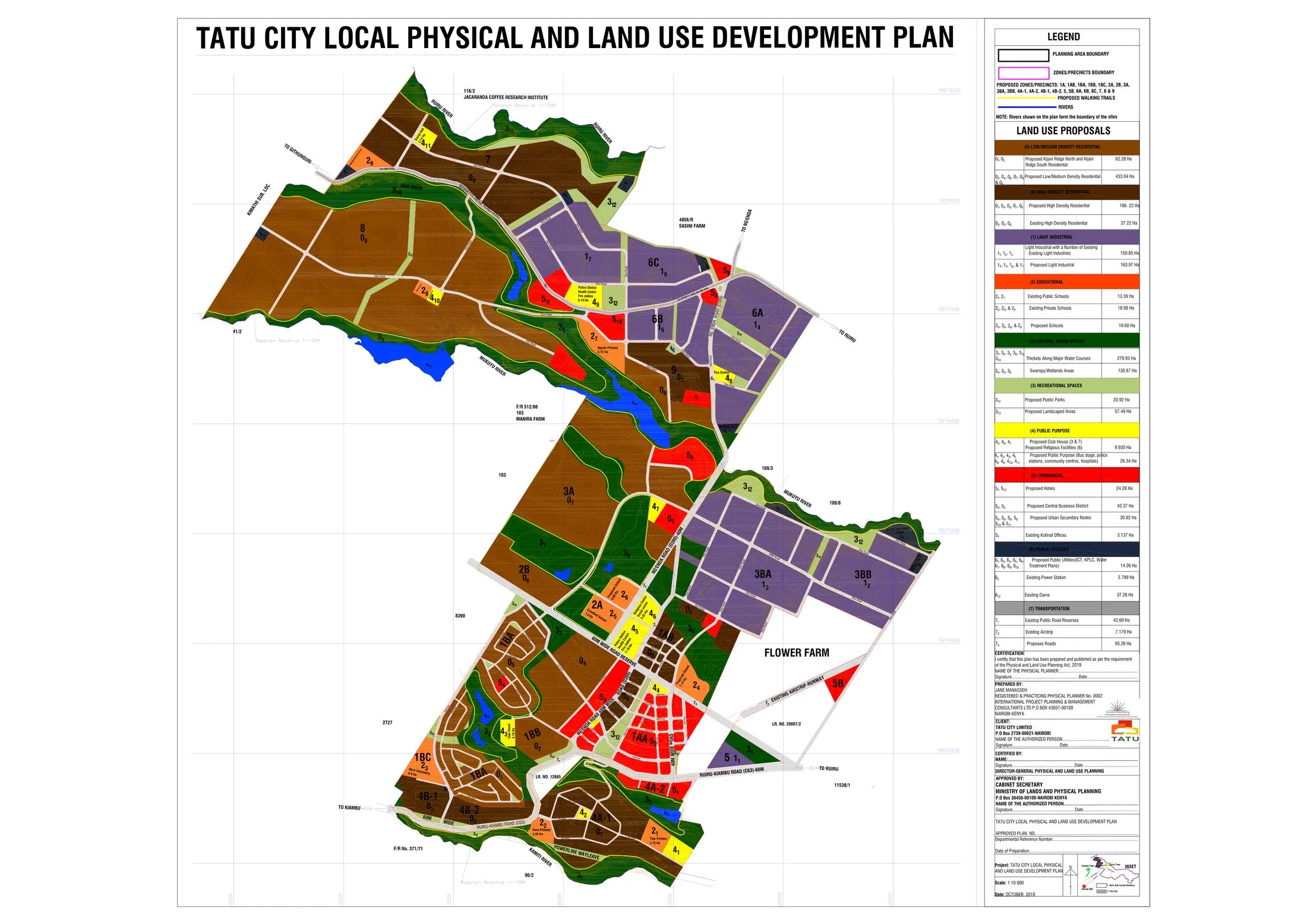
A privately developed new city on former coffee plantation land north-east of Nairobi, masterplanned from 2010 by Rendeavour, an Africa-focused new city developer. The plan combines residential neighbourhoods, schools, an industrial and logistics zone, and commercial districts within a special economic zone framework, conceived as a self-contained satellite settlement for the Nairobi metropolitan region. Development has proceeded in phases, with industrial occupiers and schools among the earliest completions.
Significance
Tatu City is one of the most advanced examples of the private new city model that spread across Sub-Saharan Africa in the 2010s, promoted as a means of decongesting overstretched capitals through satellite urbanism. It sits at the centre of debates about whether privately governed enclaves can address mass urbanisation or whether they chiefly serve middle-class and corporate demand, making it a key reference point in scholarship on African urban futures.
What shaped it
- World becomes majority urban (2007)
- Global financial crisis (2007–2009)
- Neoliberalism (1970s–1990s)
Plans it influenced
- Konza Technopolis (Kenya) (2012–)
- Nova Cidade de Kilamba (Luanda) (2011–)
Sources
- https://en.wikipedia.org/wiki/Tatu_City
- https://www.som.com/projects/tatu-city-central-business-district/