San Antonio River Walk Redevelopment
Core idea
Linear park & mixed-use along river
Why it matters
Economic + place-making engine
Description
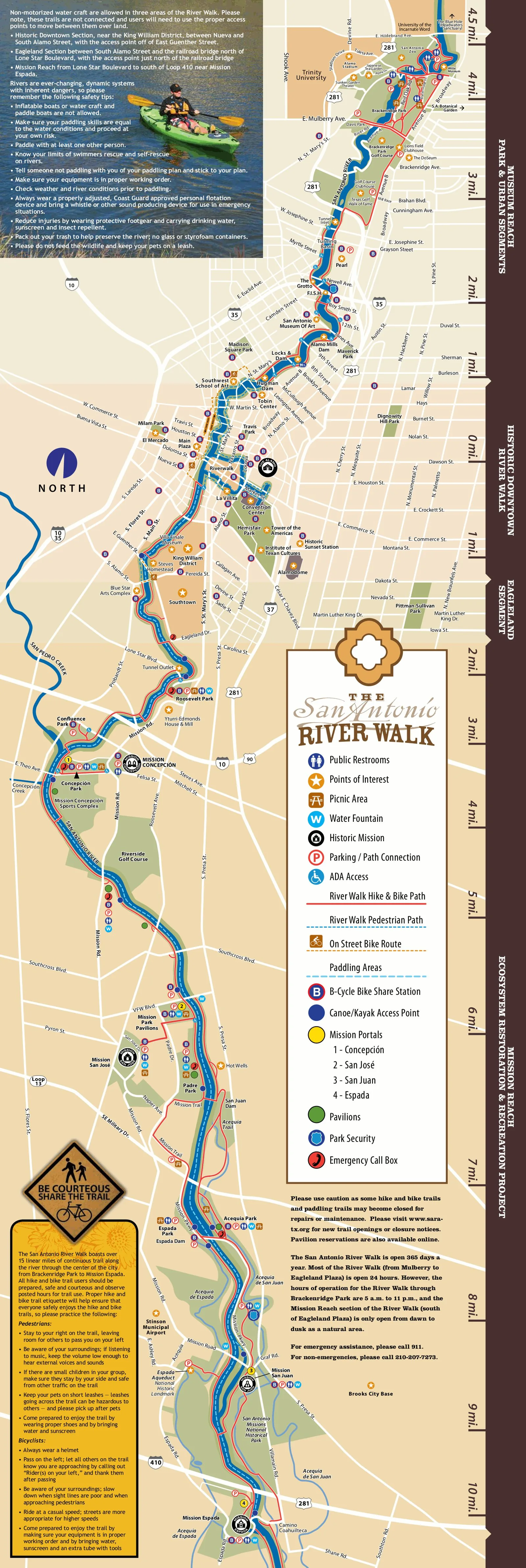
The San Antonio River Walk redevelopment extended and upgraded the city's celebrated riverside promenade through a series of publicly led projects between 1998 and 2013, most notably the Museum Reach to the north and the Mission Reach to the south. Undertaken by the City of San Antonio with county and federal partners, the work combined flood management, ecological restoration of the river channel, linear parkland and mixed-use development along the banks, linking downtown to the Spanish colonial missions.
Significance
The project demonstrated how an early twentieth-century civic amenity could be renewed as a regional economic and place-making engine, pairing tourism-driven development with habitat restoration. It is frequently cited in discussions of linear park urbanism and river corridor regeneration in North American cities.
What shaped it
- The linear park / greenway (1878 / 2009 revival)
- The public park (1843–1858)
- The Social Life of Small Urban Spaces (Whyte) (1980)
Plans it influenced
- Atlanta BeltLine (2005–)
- Tampa Downtown Riverwalk Plan (2010s–)
- Jacksonville Downtown Vision Plan (2019)
- Adelaide Riverbank Precinct Plan (2013–)