Srirangam (Temple Island City)
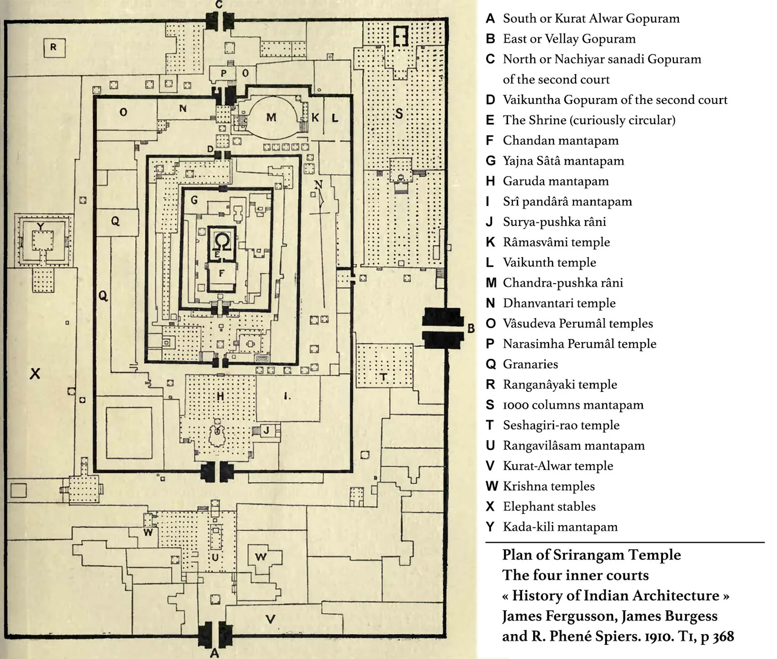
Core idea
Seven concentric rectangular enclosure walls (prakarams) around the Ranganathaswamy Temple — city as nested sacred mandala with bazaars in outer rings
Why it matters
Purest surviving expression of Hindu mandala urbanism; a living temple-city where religious geometry still structures daily life
Description
On an island in the Kaveri river, Srirangam developed over centuries as a temple-city of seven concentric rectangular enclosures (prakaras) wrapped around the Ranganathaswamy shrine. The innermost rings are sacred and priestly; the outer rings hold homes, markets, and streets — so that moving through the city is literally a movement through a cosmological diagram from the worldly to the divine.
Significance
Srirangam is the purest surviving expression of the Hindu mandala translated into a living, functioning city. It demonstrates how religious geometry can structure everyday urban life across an entire settlement, and remains one of the largest active temple complexes on Earth.
What shaped it
- Hinduism & the Vedas (c. 1500 BCE onward)
- The vastu-purusha mandala diagram (c. 6th c. CE (codified))
- Temple-tank and eri (tank) irrigation hydraulics (c. 9th c. CE onward)
Plans it influenced
- Madurai (Temple City) (c. 16th–17th c.)
- Thanjavur (Tanjore) (c. 10th–11th c.)
- Gangaikonda Cholapuram (Chola Imperial Capital) (c. 1025)
- Chidambaram (Nataraja Temple-Town) (c. 10th–13th c.)
- The Sapta-Prakaram Dravidian Temple-Town Model (codified c. 10th–17th c.)
Sources
- https://whc.unesco.org/en/tentativelists/5894/
- https://en.wikipedia.org/wiki/Ranganathaswamy_Temple,_Srirangam