Rome Sixtus V Plan
Core idea
Axial routes linking basilicas via obelisks
Why it matters
Pilgrimage-based wayfinding and urban axes
Description
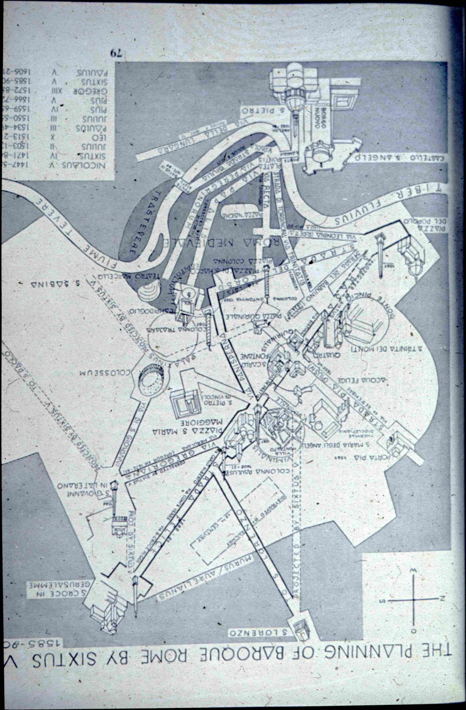
Pope Sixtus V and his architect Domenico Fontana, in just five years (1585–90), drove a network of long straight streets across Rome to connect the major pilgrimage basilicas, planting Egyptian obelisks at key junctions as visual markers terminating the vistas. The scheme imposed a legible armature of axes onto the medieval city.
Significance
The Sixtus V plan is the prototype of Baroque urbanism: the long axial avenue, the terminated vista, and the monument-as-focal-point. These devices were exported to Paris, Washington, and beyond, making Rome the school of monumental city design.
What became of it
Largely realised in its essentials and decisive for Rome's later form, though the intended extension of the Strada Felice to the Piazza del Popolo was abandoned because of severe grade changes; the axial street-and-obelisk framework still structures the historic centre today.
Critique
Driven by papal display and pilgrimage logistics, the plan imposed grand axes with limited regard for the existing dense urban fabric.
What shaped it
- The Renaissance (14th-16th c.)
- De Re Aedificatoria (1452)
- Great Fire of Rome (64 CE)
Plans it influenced
- St. Petersburg (1716)
- Karlsruhe (1715)
- Washington, D.C. (1791)
- Paris Transformations (Haussmann) (1853–1870)
- Wren’s Plan for London (unbuilt) (1666)
- Rome EUR (Esposizione Universale di Roma) (1937–)
- Versailles — the planned royal town (the Trident) (1671)
- Turin, Savoy Baroque extensions (1620s–1680s)
Sources
- https://ohiostate.pressbooks.pub/exploringarchitectureandlandscape/chapter/baroque-replanning-of
- https://en.wikipedia.org/wiki/Domenico_Fontana