Canon · Early Modern (1500–1800)
Philadelphia Plan
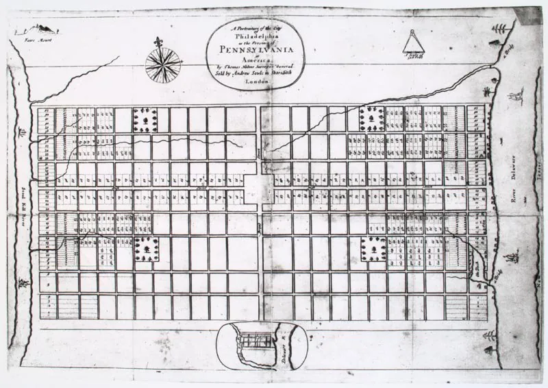
Core idea
Orthogonal plan with five parks
Why it matters
Early American model to curb fire/congestion
Description
William Penn and surveyor Thomas Holme laid out Philadelphia in 1682 between two rivers as a generous gridiron of broad, regular streets punctuated by five public squares, conceived after London's plague and fire as a healthy, fire-resistant 'greene country towne.'
Significance
Philadelphia's plan was hugely influential in North America: the rational grid plus public squares became the default template for countless American cities. It linked the grid not to speculation alone but to an ideal of open, healthy, ordered settlement.
What became of it
Realised and enduring; the grid and its five squares remain the framework of central Philadelphia, with the central square now occupied by City Hall.
What shaped it
- The grid (c. 2500 BCE)
- Plan for Rebuilding London (1666)
Plans it influenced
- Edinburgh New Town (1767)
- Washington, D.C. (1791)
- Savannah Ward Plan (1733)
- NYC Commissioners’ Plan (Manhattan Grid) (1811)
- Adelaide (Light’s Plan) (1837)
- Detroit Woodward Plan (1807)
- George Town, Penang (1786 Grid) (1786)
Sources
- https://www.tclf.org/landscapes/william-penn-philadelphia-plan
- http://paheritage.wpengine.com/article/william-penn-plans-his-city/
hub.toekom.st — History of Urbanism · an interactive timeline of 850 planned cities across 6,000 years.