Postwar & Welfare-Modernist (1945–1975)
Copenhagen Finger Plan
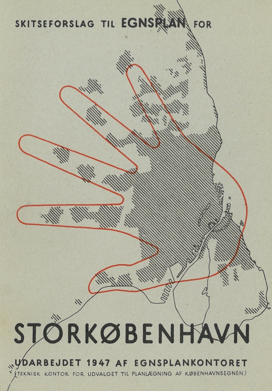
Core idea
Rail ‘fingers’ with green wedges
Why it matters
Durable polycentric regional form
Description
Copenhagen's 1947 Finger Plan channeled metropolitan growth along five rail corridors radiating from the dense historic core — the 'fingers' — while preserving the green wedges between them for farmland and recreation, tying urban expansion directly to transit.
Significance
The Finger Plan is the world's most celebrated model of transit-oriented metropolitan growth, still guiding Copenhagen seventy-five years on. It anticipated and exemplifies what is now called transit-oriented development at regional scale.
What shaped it
- The metro / underground railway (1863)
- The green belt (1898 concept / 1938 law)
- Garden Cities of To-Morrow (1898 / 1902)
- Survey-before-plan (1915)
Plans it influenced
- Zurich Richtplan + S-Bahn (1990–)
- Randstad / Green Heart Concept (1958)
- Almere 2.0 Structuurvisie (2009)
- Copenhagen Finger Plan (2007 update) (2007)
- Stockholm RUFS 2050 (2018)
- Portland UGB + Metro 2040 (1979/1995)
- Helsinki City Plan 2016 (2016)
- Riga Development Plan 2030 (2014)
Sources
Open it on the interactive timeline →hub.toekom.st — History of Urbanism · an interactive timeline of 850 planned cities across 6,000 years.